
The Top Day and Multi-day Hiking Trails in Namibia
Written by Jess Tyrrell
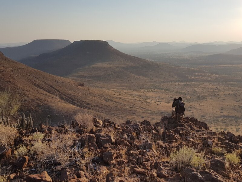
Fancy feeling the sun and breeze directly on your skin, being within arm's length of wildlife, and listening to silence on your next holiday? Then hiking is just the activity for you! And there is no better place to feel the soft sand shifting beneath your boots, or to rock scramble across picturesque scenery, than in Namibia. The vastness and diversity of landscapes mean that from one day to the next you could be hiking over hilly, flat, rocky, sandy or grassy terrain, and have it all to yourself! Whichever route you choose to do, be it a stroll, a full-day hike or a multi-day adventure, Namibia has a trail for you.
Read on for a comprehensive list of the most beautiful and rewarding unguided and guided day and multi-day hikes in Namibia, as well as their difficulty level, starting points and what to expect.
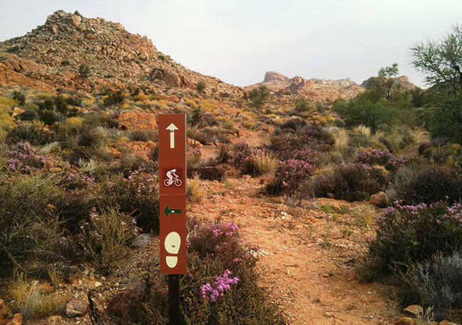
Before we get into the nitty-gritty, we’d recommend that you download a nifty hiking app on your phone that stores offline maps and routes and gives helpful tips. Our favourites are Pocket Earth, Trailforks and Alltrails.
Day hikes
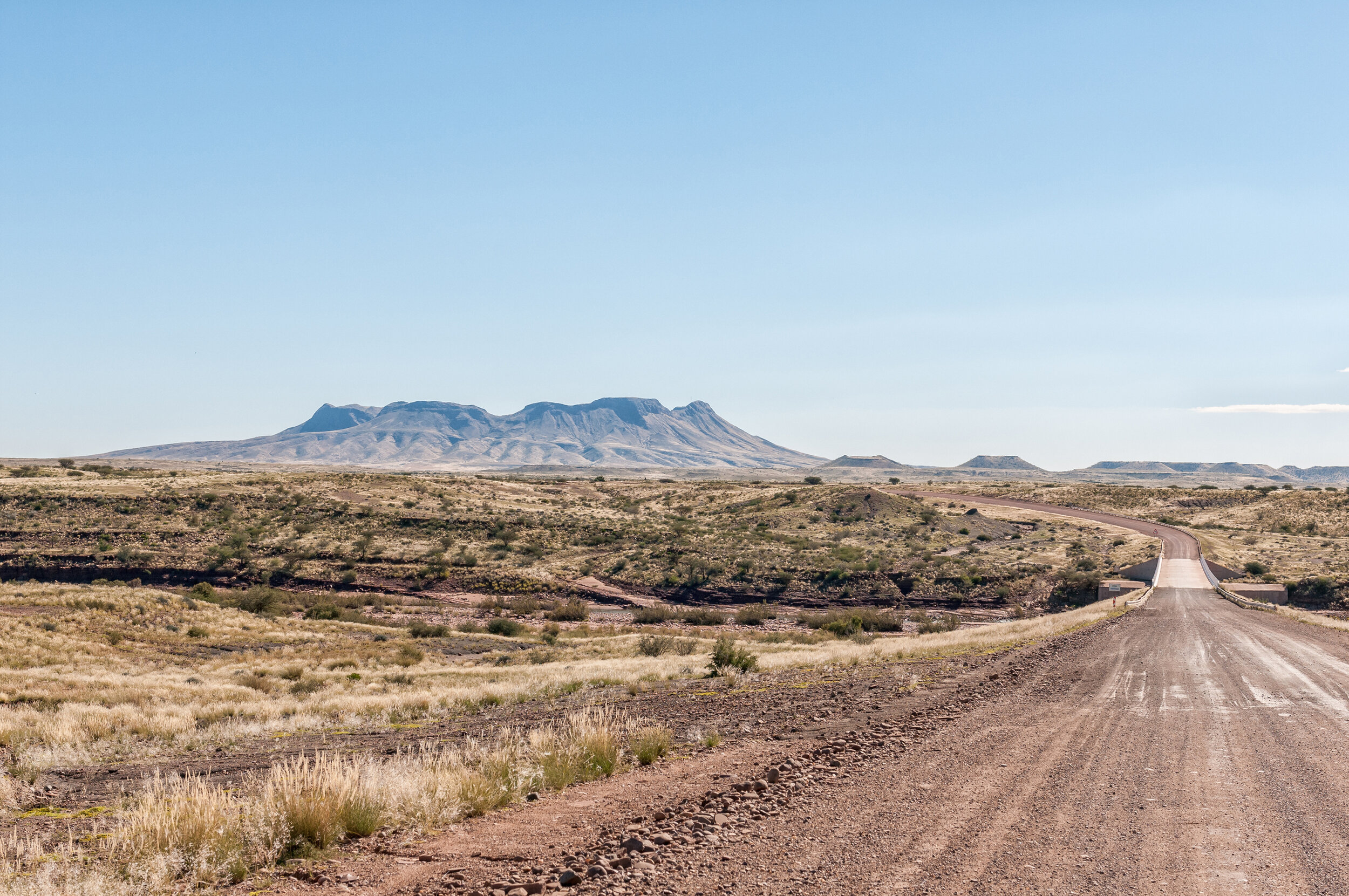
1. Olive Trail, Namib Naukluft Park
Level: Moderate/Hard
Distance: 10 km
Elevation gain: 409 m
Accessible: All-year-round
Drinkable water on route: No
Starting point: Just before the NWR Naukluft camp on the eastern side of the Naukluft Mountains
Close to: Sossusvlei, Sesriem, Solitaire
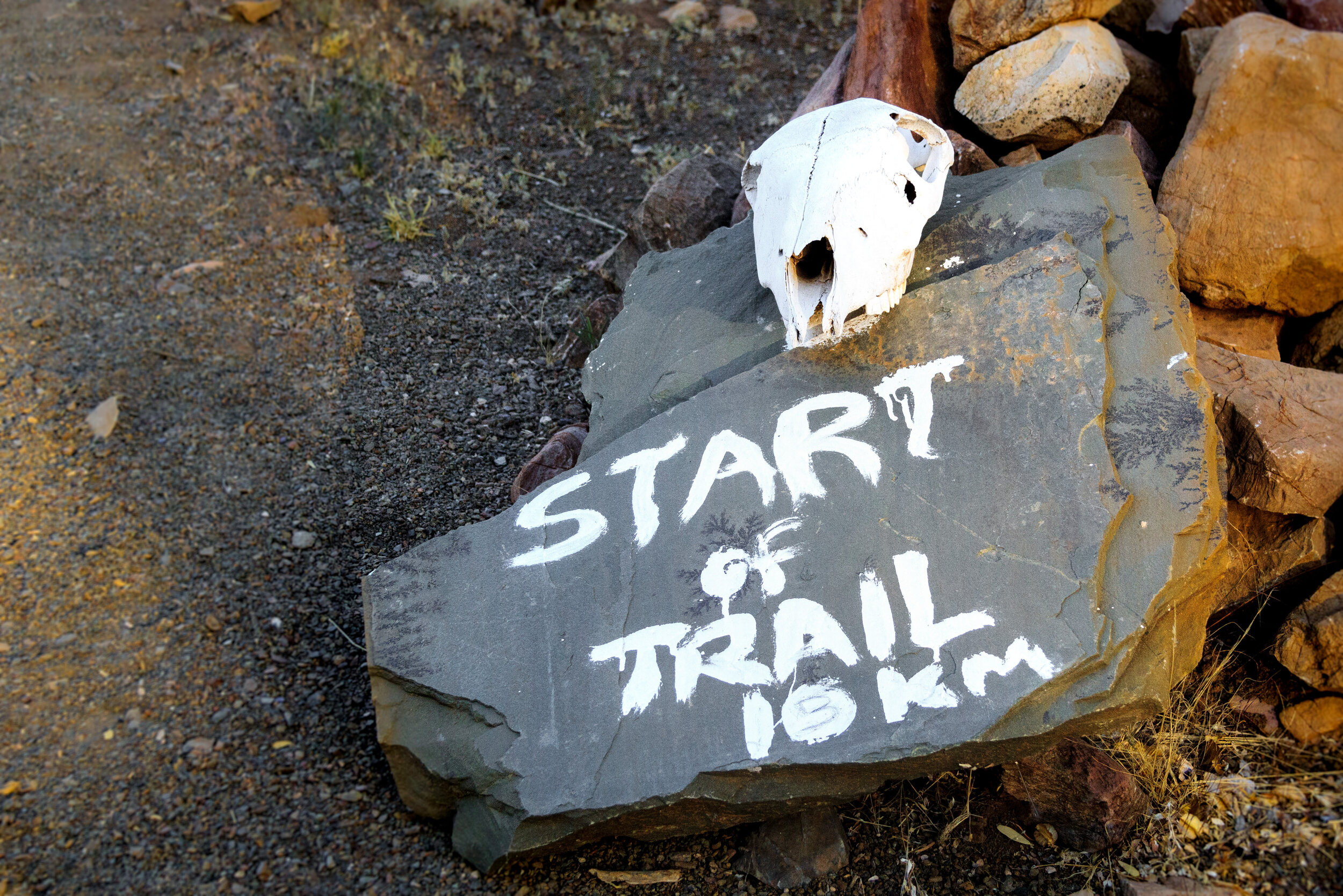
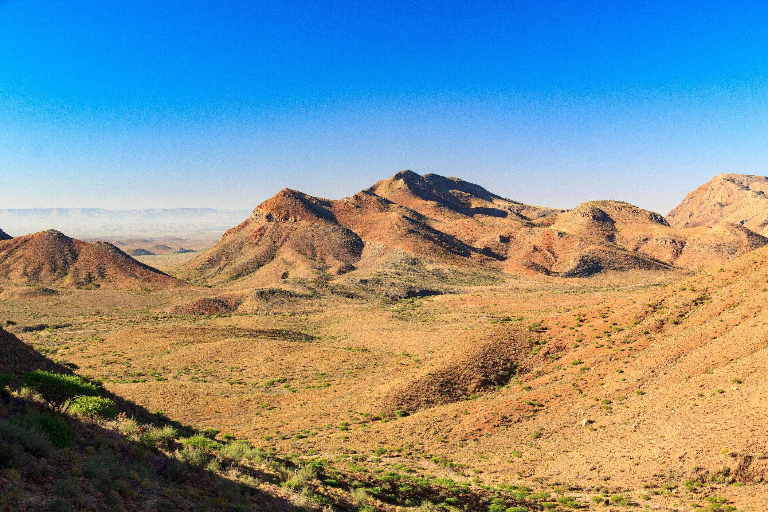
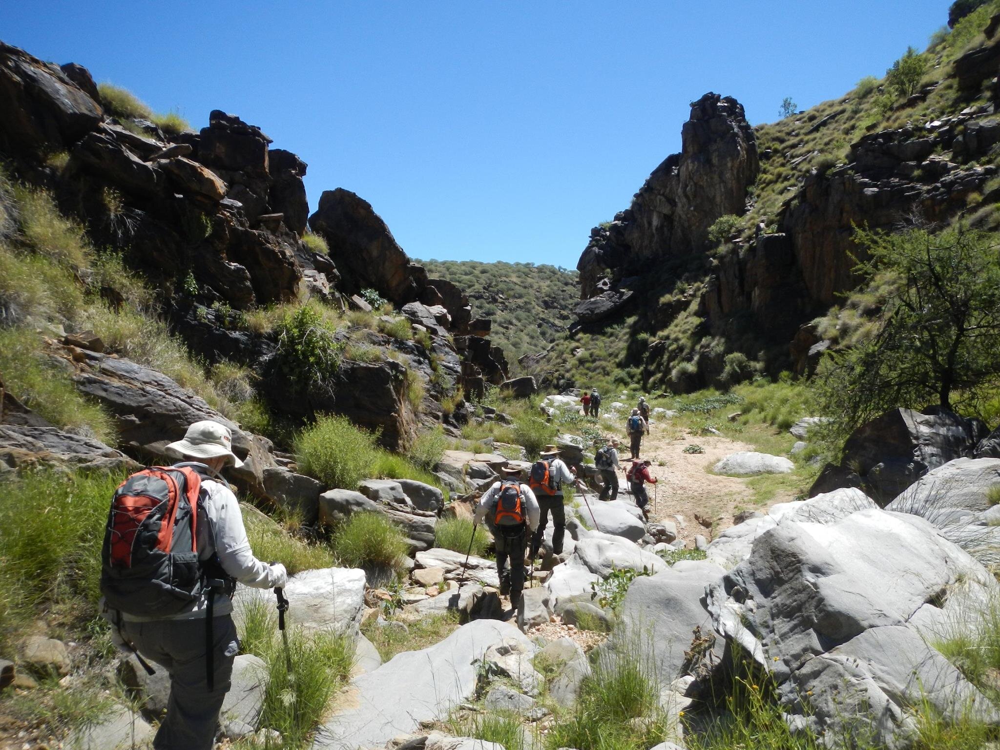
The lightly-trodden “Olive Trail” is a 10 km route that loops through the magnificent Naukluft mountains in Namibia's Namib Naukluft Park, affording breathtaking scenery and wildlife sightings. This trail takes around 4-5 hours to complete and is quite exposed. Following the white footsteps, you will first ascend the plateau, atop which are panoramic views of the wide rocky plain. The path then dips down into a rugged ravine along which you will have to jump over large rocks and cross pools along elevated chains attached to the cliff face (this is not for the fainthearted!). Keep an eye out for Hartmann Zebra, Kudu, Baboon, Klipspringer, Dassies and several bird species, including black eagles.
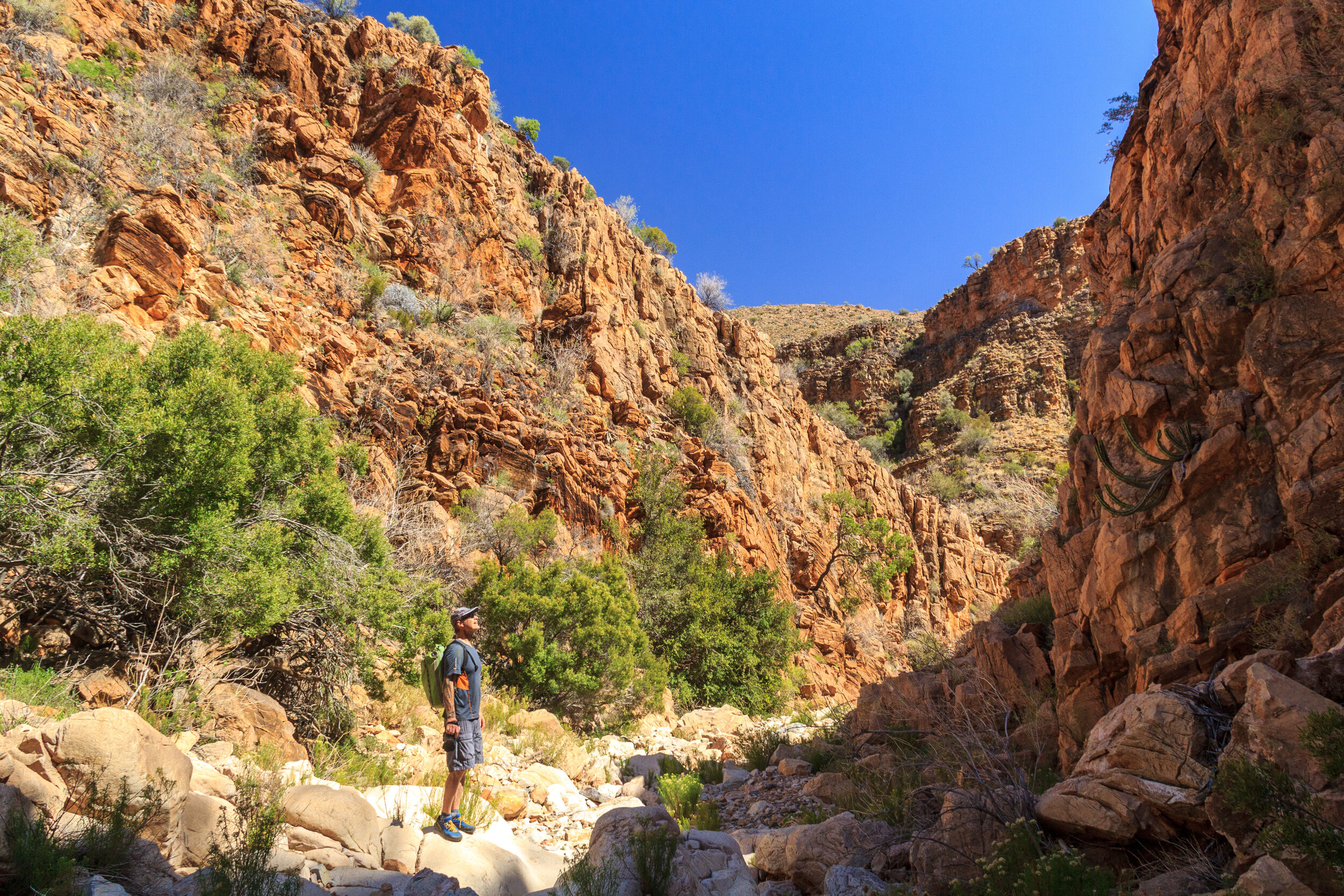
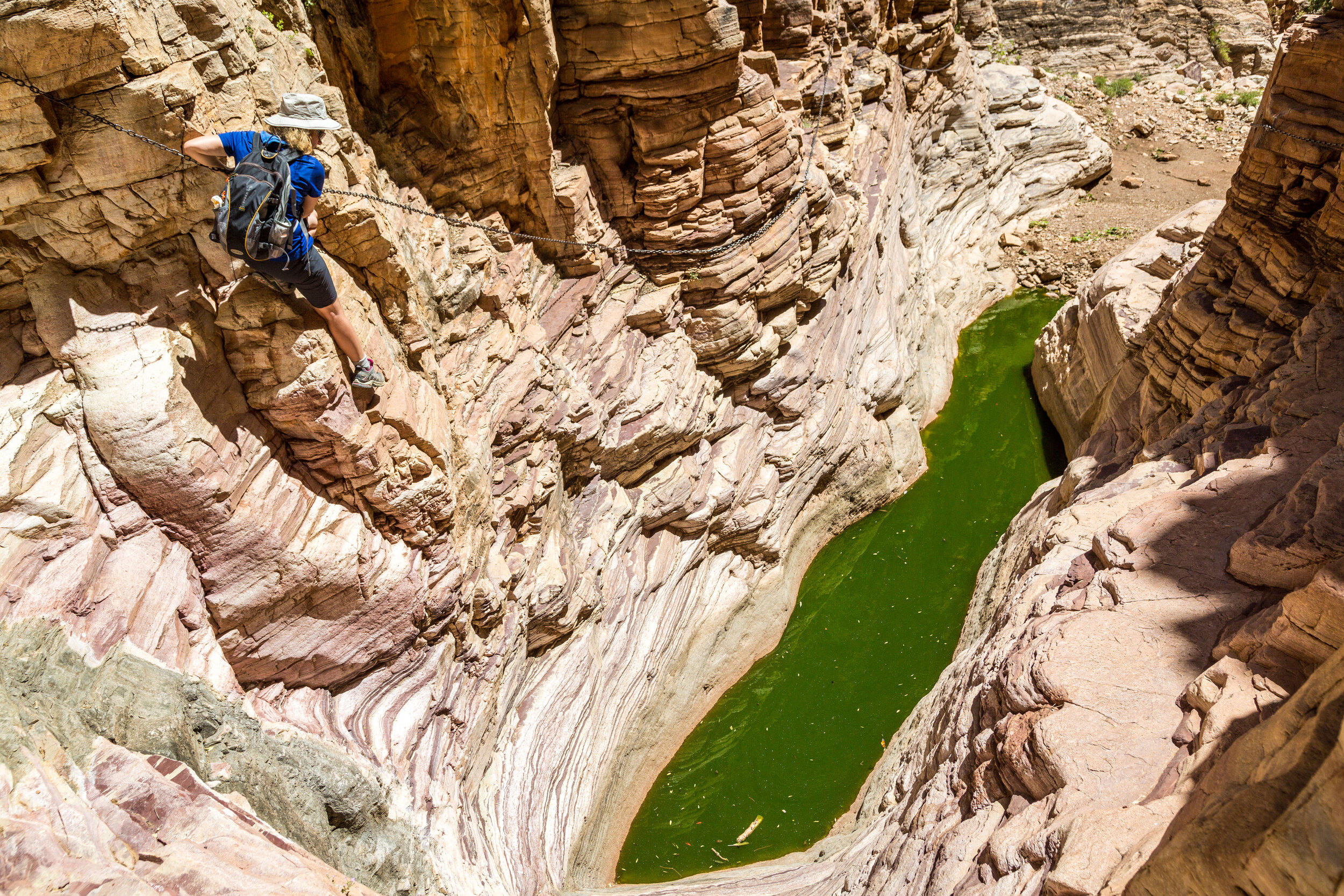
2. Waterkloof Trail, Namib Naukluft Park
Level: Hard
Distance: 17 km
Elevation gain: 550 m
Accessible: All-year-round
Drinkable water on the route: Yes
Starting point: The NWR Naukluft camp on the eastern side of the Naukluft Mountains
Close to: Sossusvlei, Sesriem, Solitaire
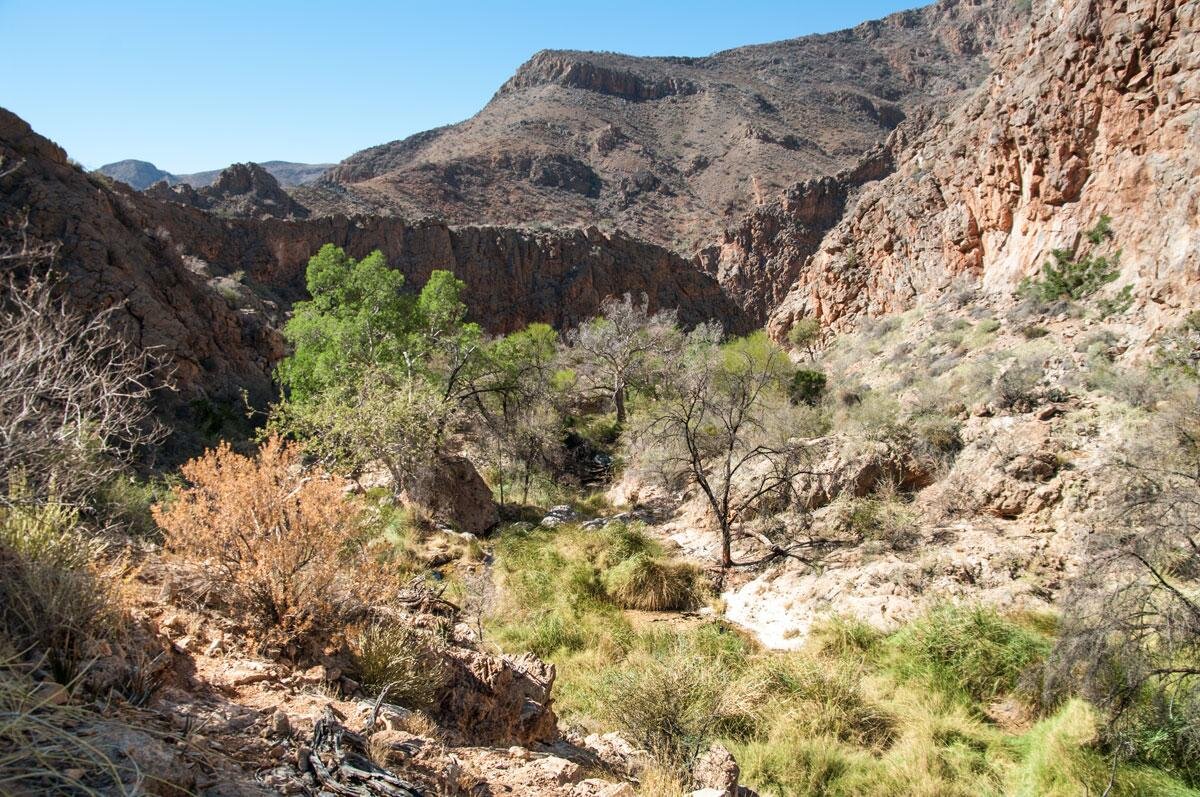
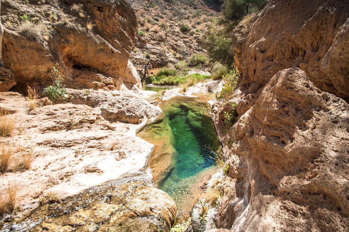
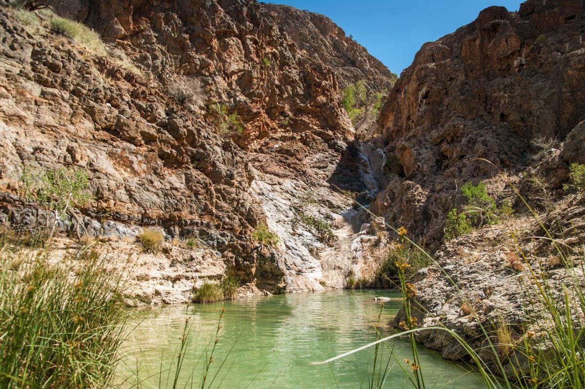
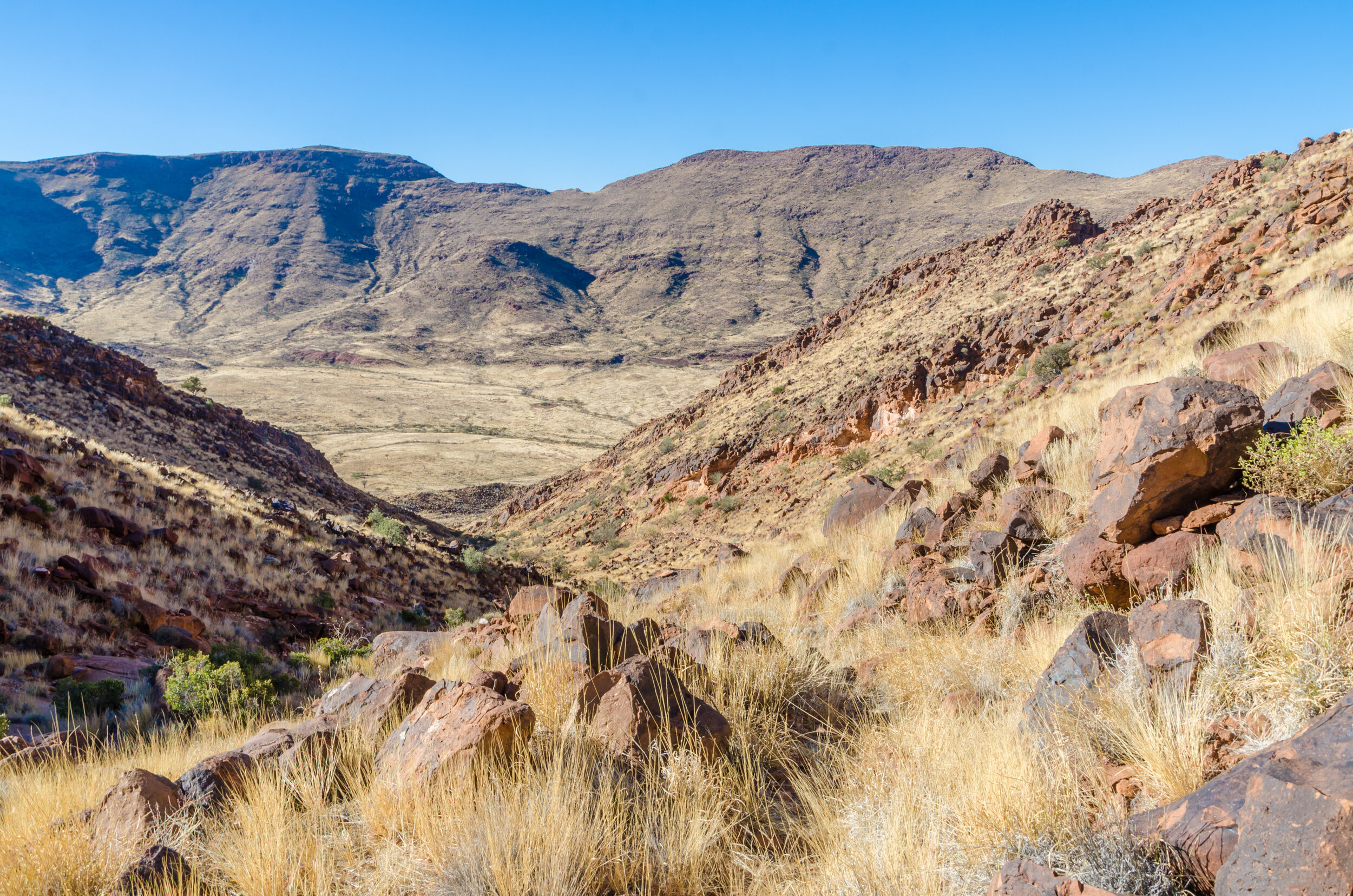
Just down the road from the Olive Trail is the longer, more strenuous Waterkloof Trail. Similarly, this trail winds through stark and rocky gorges, offering opportunities for swimming in the natural pools. It will take 6-8 hours to finish the loop, and you should be fit and experienced in hiking. You will start at the shady camp run by Namibian Wildlife Resort, following the yellow footsteps along a winding path along a stream of drinking water to a clear pool where you can take a refreshing dip. You will then hike through pristine, steep mountain landscapes that reward you with breathtaking views of the Naukluft Mountains. Descend to more pools and springs, before continuing through the gorge back to camp.
3. The Rock Sculpture Trail, Namib Naukluft Park
Level: Easy/Moderate
Distance: 3 - 5 hours
Accessible: All-year-round
Drinkable water on route: No
Starting point: North east of the Bloedkoppie in the Namib section of the Namib Naukluft Park
Close to: Swakopmund, Walvis Bay
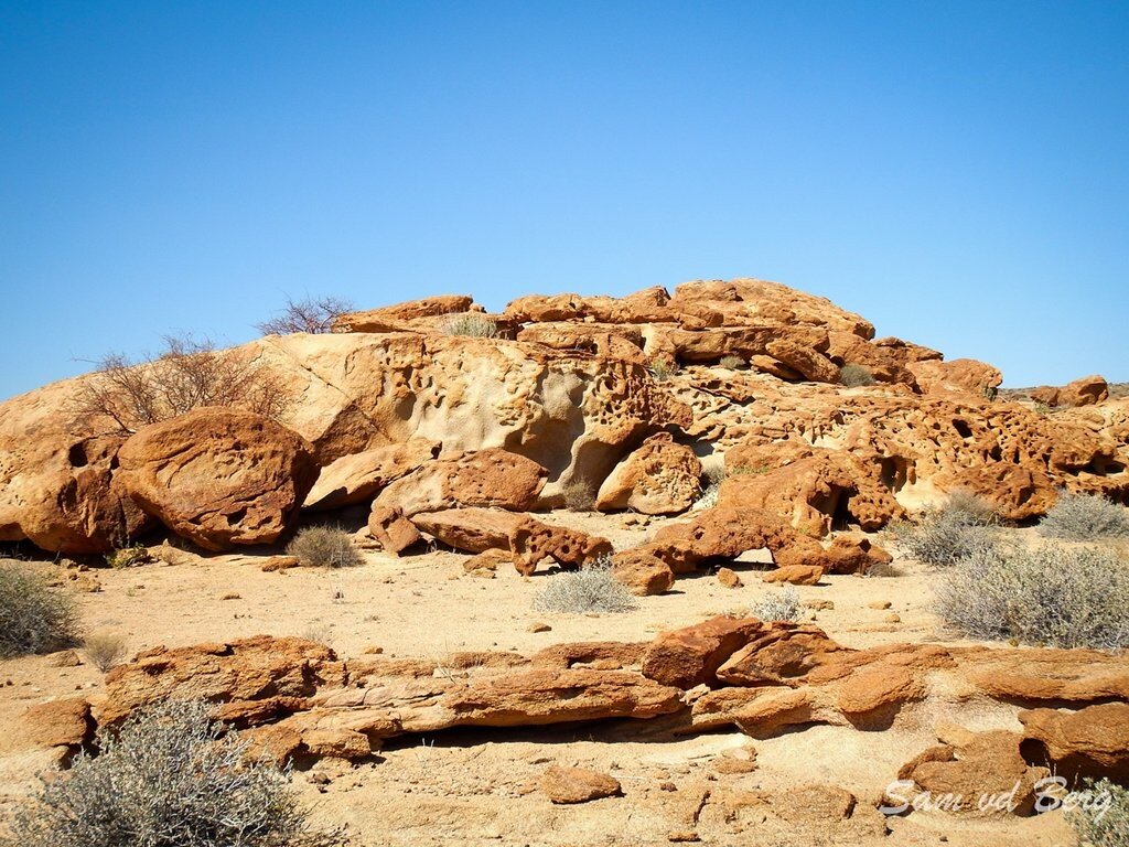
The Rock Sculpture Hiking Trail is in the remote Namib section of the Namib Naukluft Park, east of Swakopmund and Walvis Bay. The trail starts and ends to the northeast of Bloedkoppie (Blood Mountain) — also deserving of a quick ascent for magnificent views — at the Rock Arch Campsites, close to Tinka’s plain. Head out for the hike early in the morning, keeping an eye out for signboards that mark the trail. This 3- to 5-hour long nature walk will take you through the fascinating red granite landscape, eroded over centuries to form an open-air sculpture 'gallery'. Before venturing into this fascinating area, you will need to purchase an entry permit from the Ministry of Environment and Tourism office, either in Swakopmund (064 40 4576) or Walvis Bay (064 20 5971). Make sure to ask for a physical map of the trail! You can also contact the Namibia Wildlife Resorts reservation office in Windhoek at reservations@nwr.com.na to enquire about camping in the area.
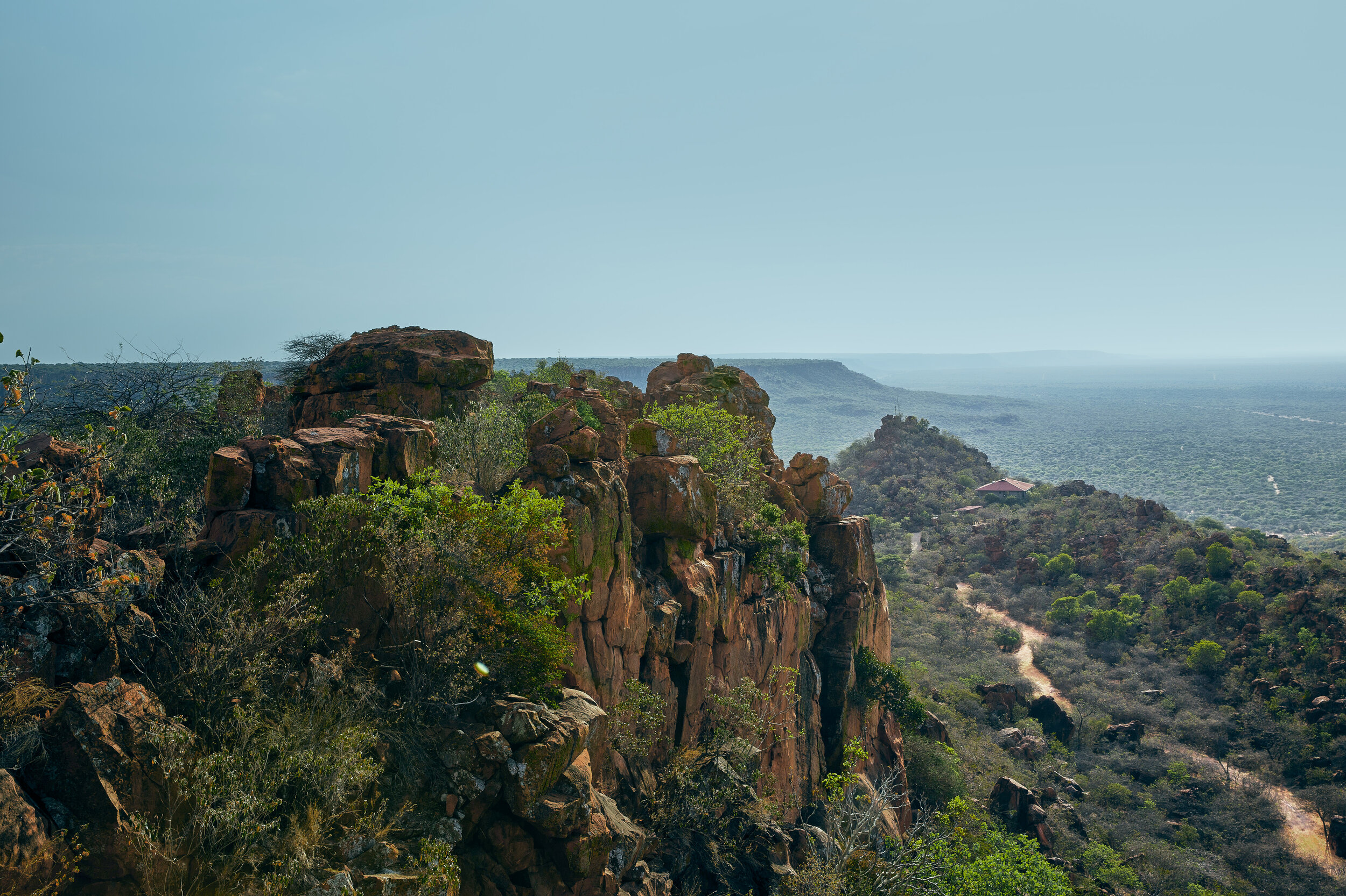
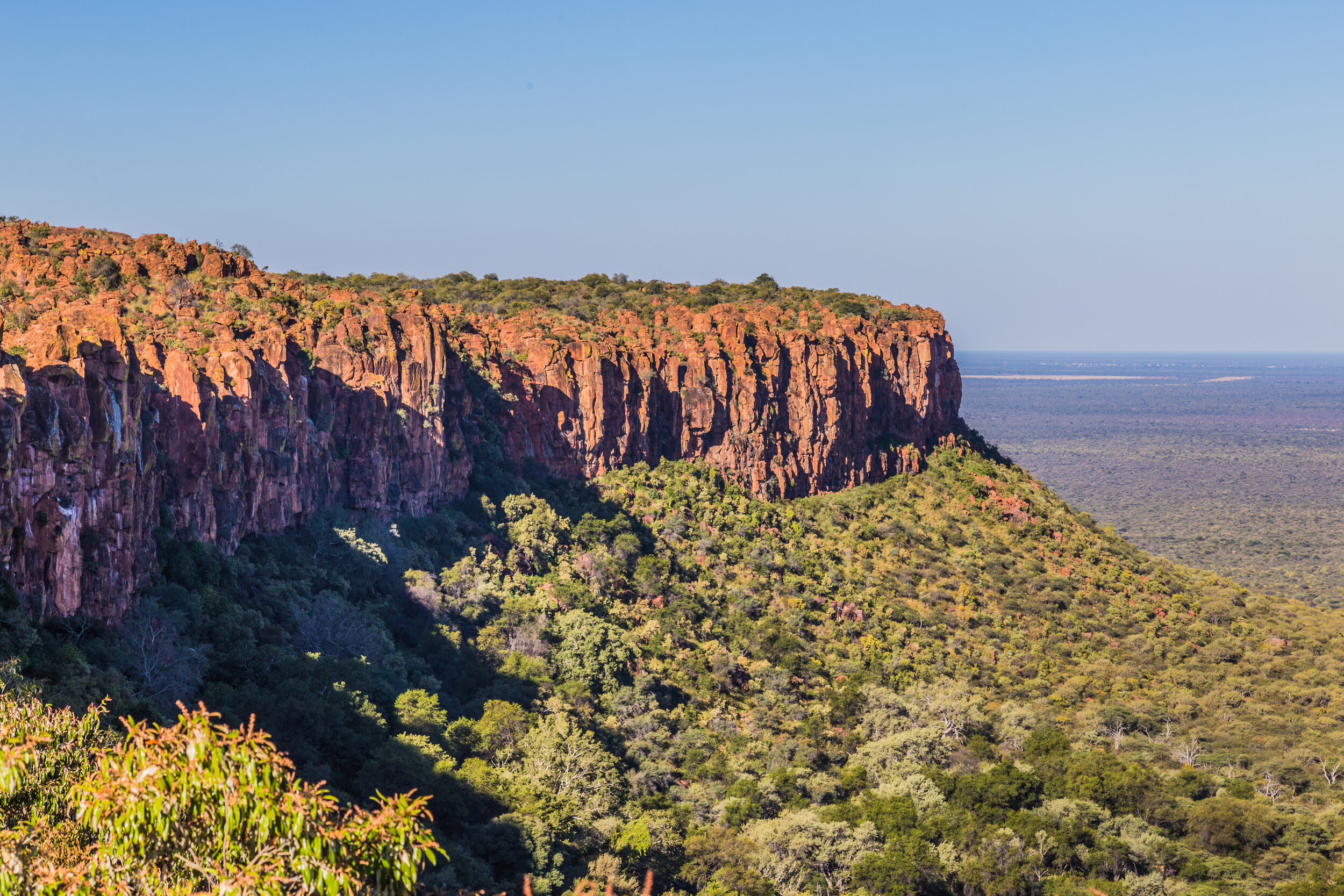
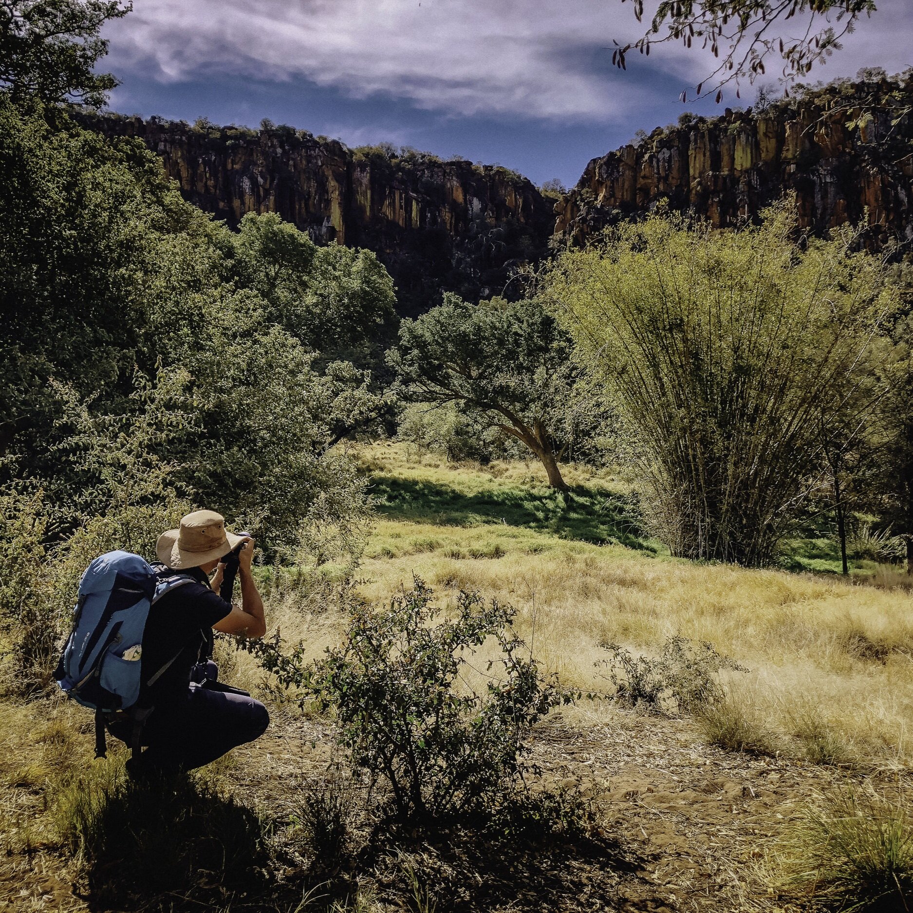
4. Namibia’s Table Mountain - The Waterberg Plateau
4.1 Dassie, Fountain and Porcupine Trail Loop, Waterberg Plateau
Level: Easy/Moderate
Distance: 10.5 km
Accessible: All-year-round (best between May and November)
Drinkable water on the route: Yes
Starting point: The Waterberg Plateau Campsite
Close to: Otjiwarongo, Okonjima, Etosha National Park
The towering Waterberg Plateau rises some 200 m above the surrounding plains of the Kalahari and is covered in lush vegetation due to a series of springs on the lower slopes. The Dassie, Fountain and Porcupine Trail Loop is a 10.5-kilometre trail that starts and ends at the Waterberg Plateau Campsite. First off, you will meander along the lush base of the plateau into a ravine. You will then double back along the stream, making your way to the ascent. A quick 40-minute steep ascent will get you to the Mountain Viewpoint, bearing panoramic views of the Kalahari's thorny-treed savannah plains. You will then traverse along the slope, finally making your way down a gradual decline to camp.
4.2 Aloe Circle, Fig Tree Walk, and Mission Way, Waterberg Plateau
Level: Easy/Moderate
Distance: 3.9 km
Elevation gain: 198 m
Accessible: All-year-round (best between May and November)
Drinkable water on the route: Yes
Starting point: NWR Waterberg Rest Camp
Close to: Otjiwarongo, Okonjima, Etosha National Park

From NWR Waterberg Rest Camp, you will first take the gentle Rasthaus Way towards the plateau, opting to take the short Aloe Circle detour loop on your right. You will reach Anthill Way where there are several chalets, before traversing across the base of the plateau along Fig Tree Walk. Begin to climb until you reach a split in the road. If you go right and upward, you can make your way to the Waterberg Plateau viewpoint, with spectacular views of the surrounding plateau and plains. From the split, descend Mountain View Walk until reaching some restrooms, continuing onto Francolin Walk, reaching the stream and Mission Way. After a left turn, you will be back at Waterberg Rest Camp.
4.3 Mountain Viewpoint - NWR Waterberg Rest Camp, Waterberg Plateau

A steep, 45-minute ascent to the top of the plateau from Waterberg Rest Camp, offering sublime sunrise views!
4.4 Waterberg Wilderness Private Nature Reserve Plateau (guided)

Spend 2-3 hours rising 150 m and exploring the Waterberg’s wilderness with an expert guide, magnificent views of the Kalahari guaranteed! Your guide will teach you all about the plants and animal life in the region as well as the life and culture of the local Herero people.
5. White Lady Rock and Brandberg Mountain (guided)
Level: Easy
Distance: 5 km
Elevation gain: 86 m
Accessible: All-year-round
Drinkable water on the route: No
Starting point: Dhaureb Visitor Centre/Parking Lot
Close to: Erongo Region, Uis, Spitzkoppe, Henties Bay, Waterberg Plateau National Park
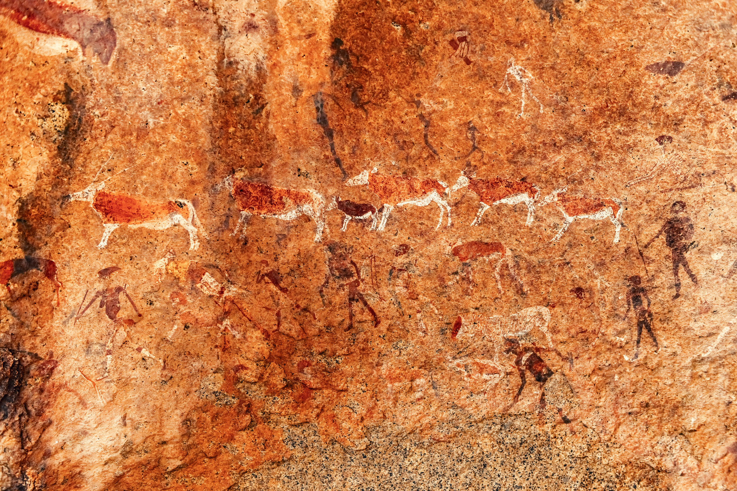
At the base of Namibia's highest peak - Brandberg Mountain - is a 5 km return trail that follows a river into a boulder lined gorge, ending at an archaeological gem and protected heritage site, White Lady Rock. The White Lady is a bushman painting in the Maack Shelter cave that dates back as many as 2.000 years. It depicts human figures and oryx across a panel measuring 5.5 m x 1.5 m, the most detailed of which is “The White Lady”. Hiking here will take you around 45-60 minutes over rough and dry terrain. You can only do this hike with an official guide.
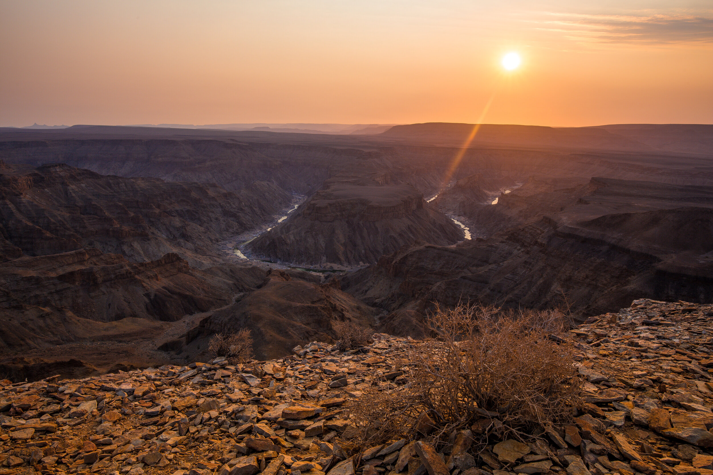
6. Fish River Canyon with Journeys Namibia (guided)
Level: Easy to Moderate
Accessible: April - September
Drinkable water on the route: No
Starting point: Fish River Lodge
Close to: Seeheim, Keetmanshoop
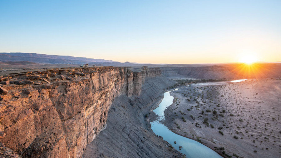
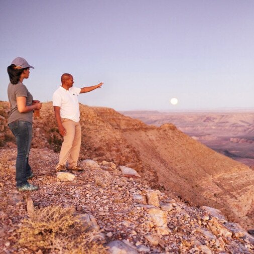
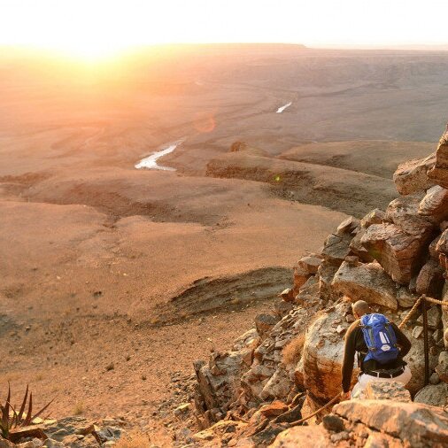
From Journeys Namibia’s Fish River Lodge you can do guided day-hikes between April and September into and around the majestic Fish River Canyon — the second largest canyon in the world. Have lunch on the craggy slopes and a well-deserved swim in the rockpools in the heart of the canyon, all without having to camp overnight or carry any equipment.
Full-day: This 8-10 hour, full day adventure will see you slowly descend from the rim to the upper part of the canyon. After navigating the rocky slopes, you will find yourself at a series of permanent rock pools in the riverbed. Have a cooling swim and then enjoy a delicious lunch served by your guides! Having recharged and rested your legs, you will make the ascent back to the lodge.
Half-day: A 4-5 hour return hike that takes you to a spectacular viewpoint along the canyon.
The full or half-day canyon hike can only be booked through res2@journeysnamibia.com or fishriver@journeysnamibia.com.
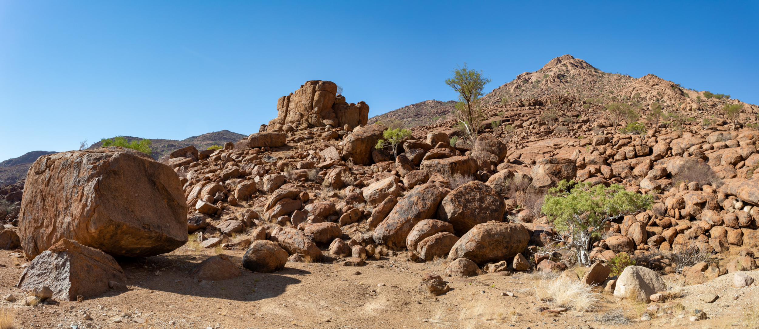
7. The 'Matterhorn of Africa' - Pontok, Matterhorn and Bushman Circle Routes, Spitzkoppe
Level: Moderate - Hard
Distance: Various
Elevation gain: ≈ 700 m
Accessible: All-year-round
Drinkable water on the route: No
Starting point: Spitzkoppe Campsite or Spitzkoppen Lodge
Close to: Erongo Region - Brandberg Massif, Henties Bay, Dorob National Park, Swakopmund, Omaruru
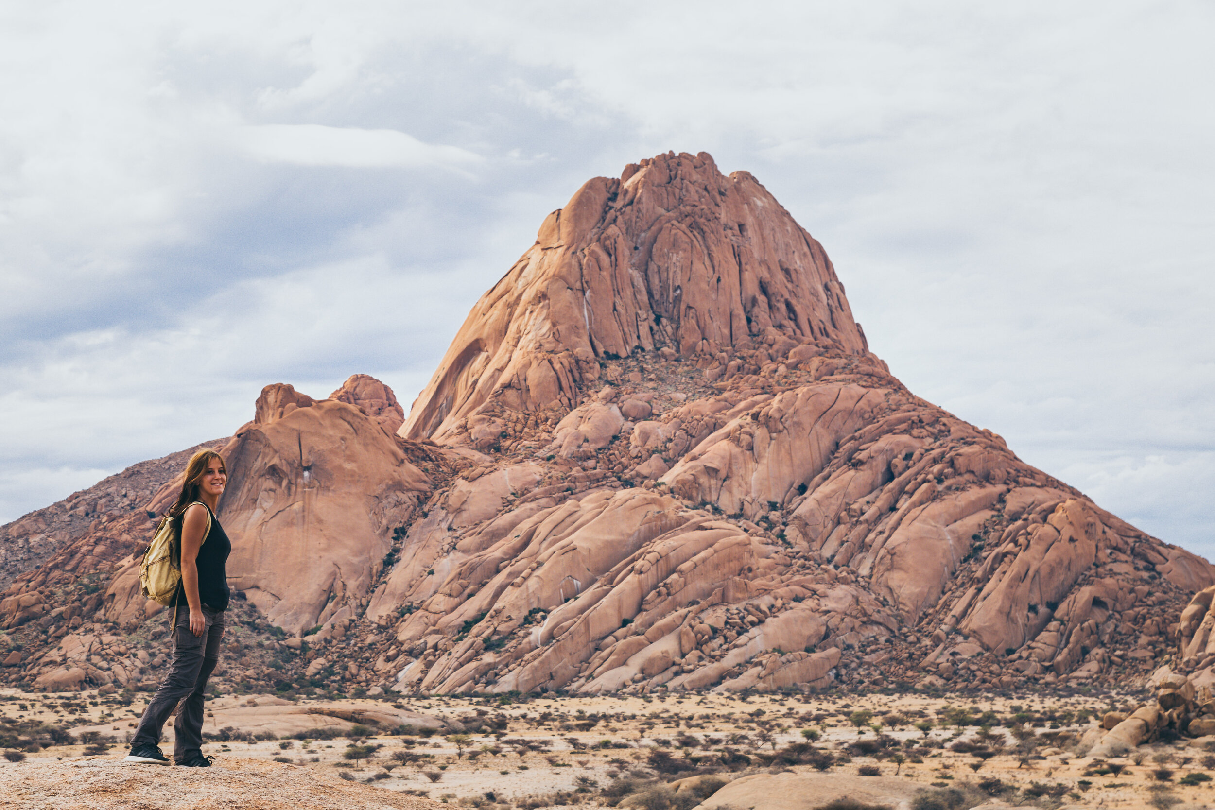
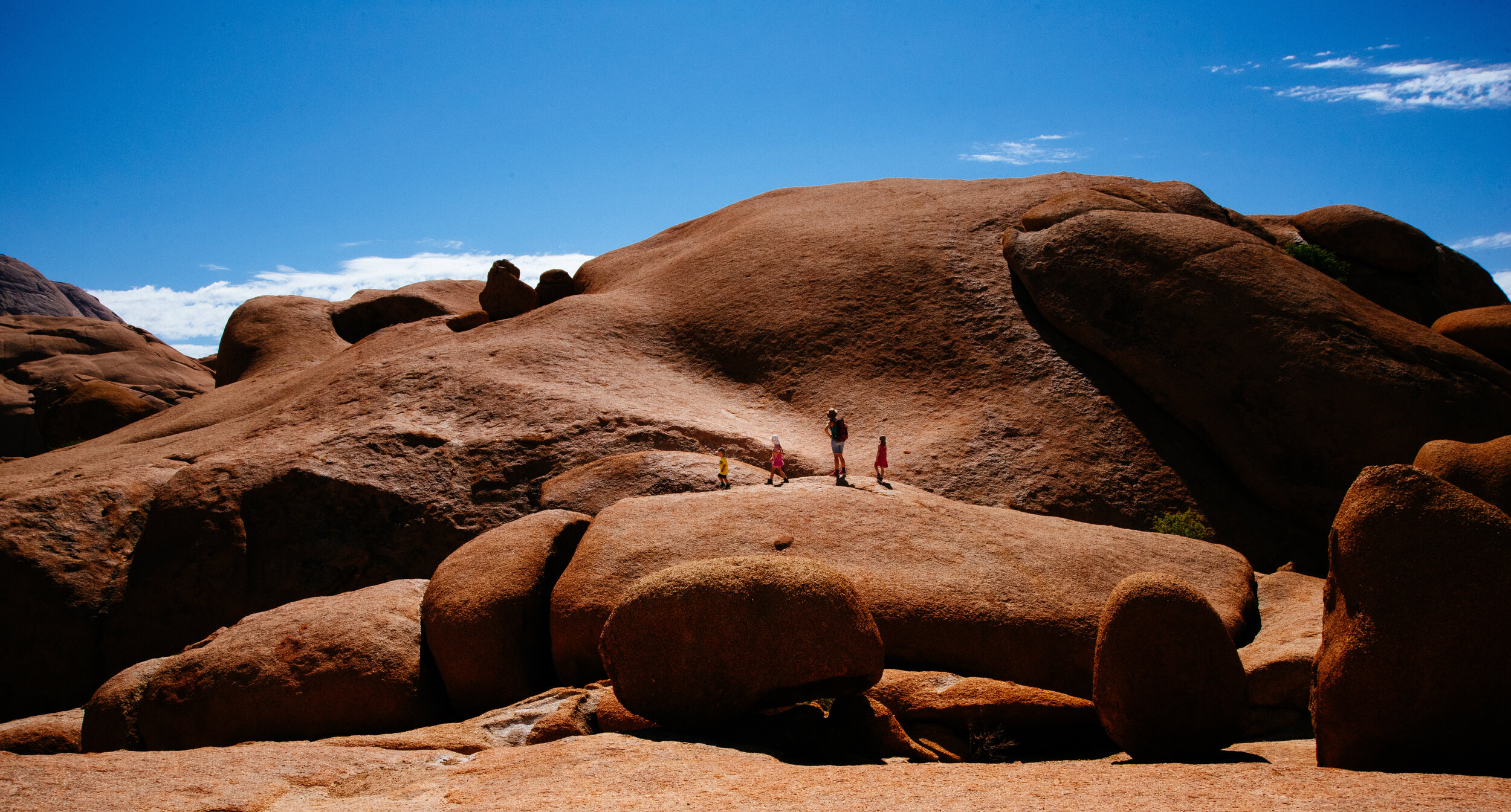
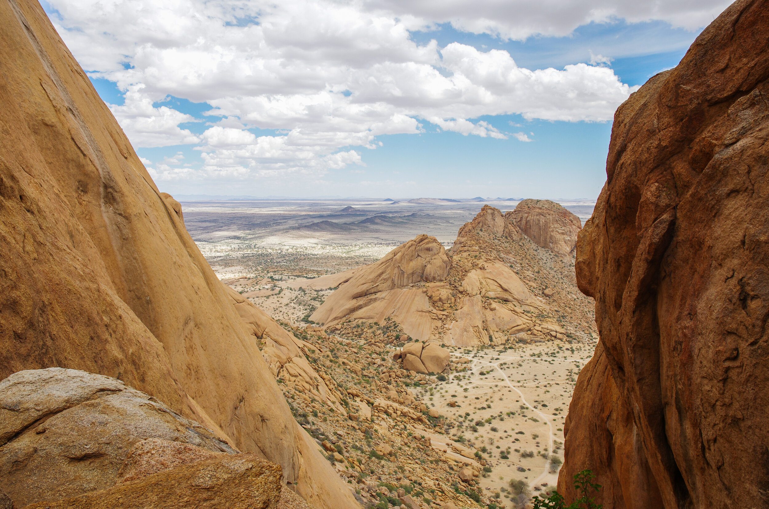
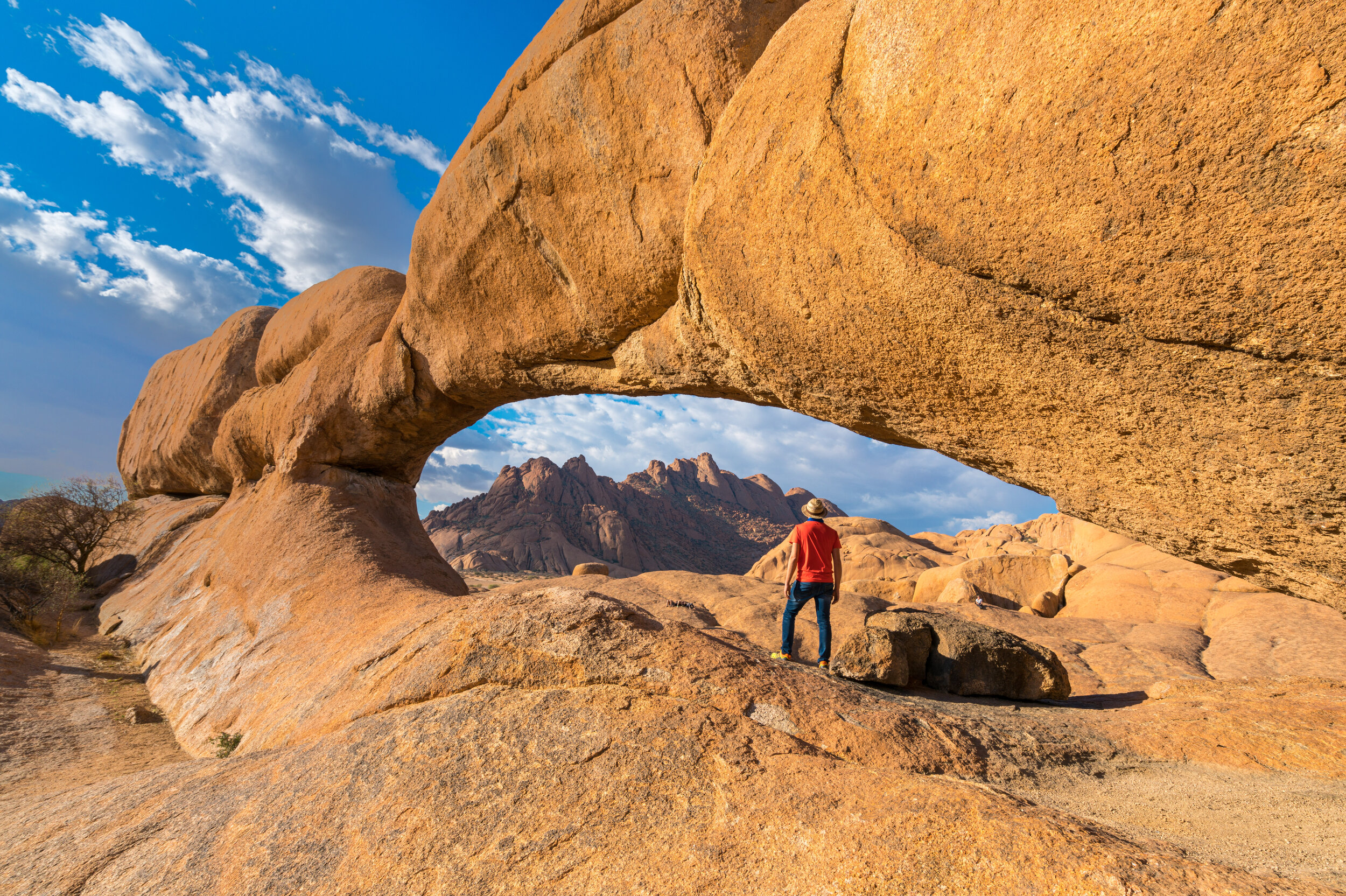
The smooth rocks and crags of Spitzkoppe draw climbing and hiking enthusiasts from all over. Exploring the massive boulders, arches and folds are fun enough, but for those intrepid hikers who want to conquer the granite peaks, you're in luck - there are 3 hiking trails you can choose from! Keep in mind that you can only do these hikes with a local guide to ensure that there is minimal impact on Spitzkoppe's fragile ecosystems. You can very easily book a local guide at the community-run Spitzkoppe campsite. The Matterhorn is the most difficult route and will take you between 6-8 hours to reach the highest possible hiking point. The Pontok Route will take between 4-5 hours and the Bushman Circle Route will take you between 6-7 hours. All routes offer you the chance to admire the awe-inspiring landscape and to marvel at ancient San rock art.
8. Brukkaros Mountain Summit, Karas Region
Level: Moderate
Distance: Depends on the route taken (from the lower campsite, between 7 km and 17 km)
Elevation gain: ≈ 600 m
Accessible: All-year-round
Drinkable water on the route: No
Starting point: Upper campsite at the base of the Brukkaros Mountain
Close to: Berseba, Keetmanshoop, Seeheim, Fish River Canyon
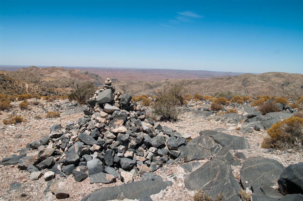
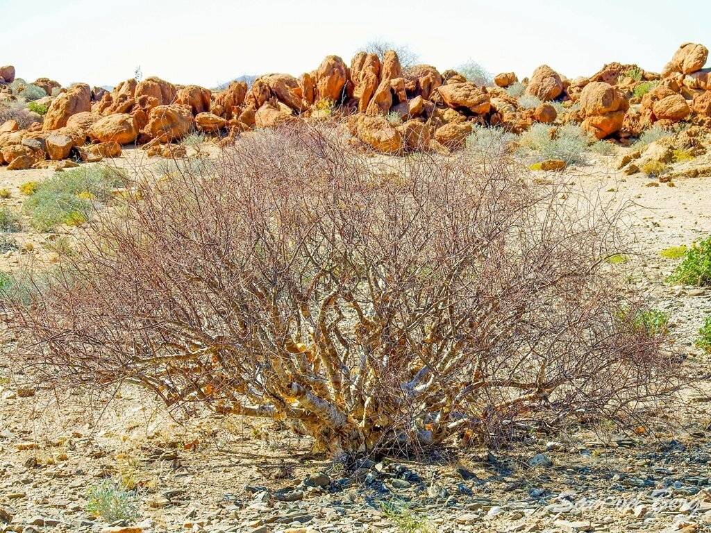
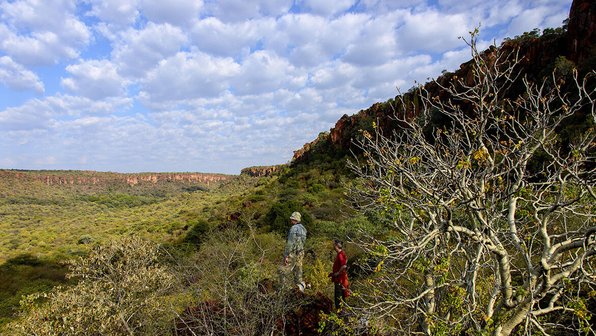
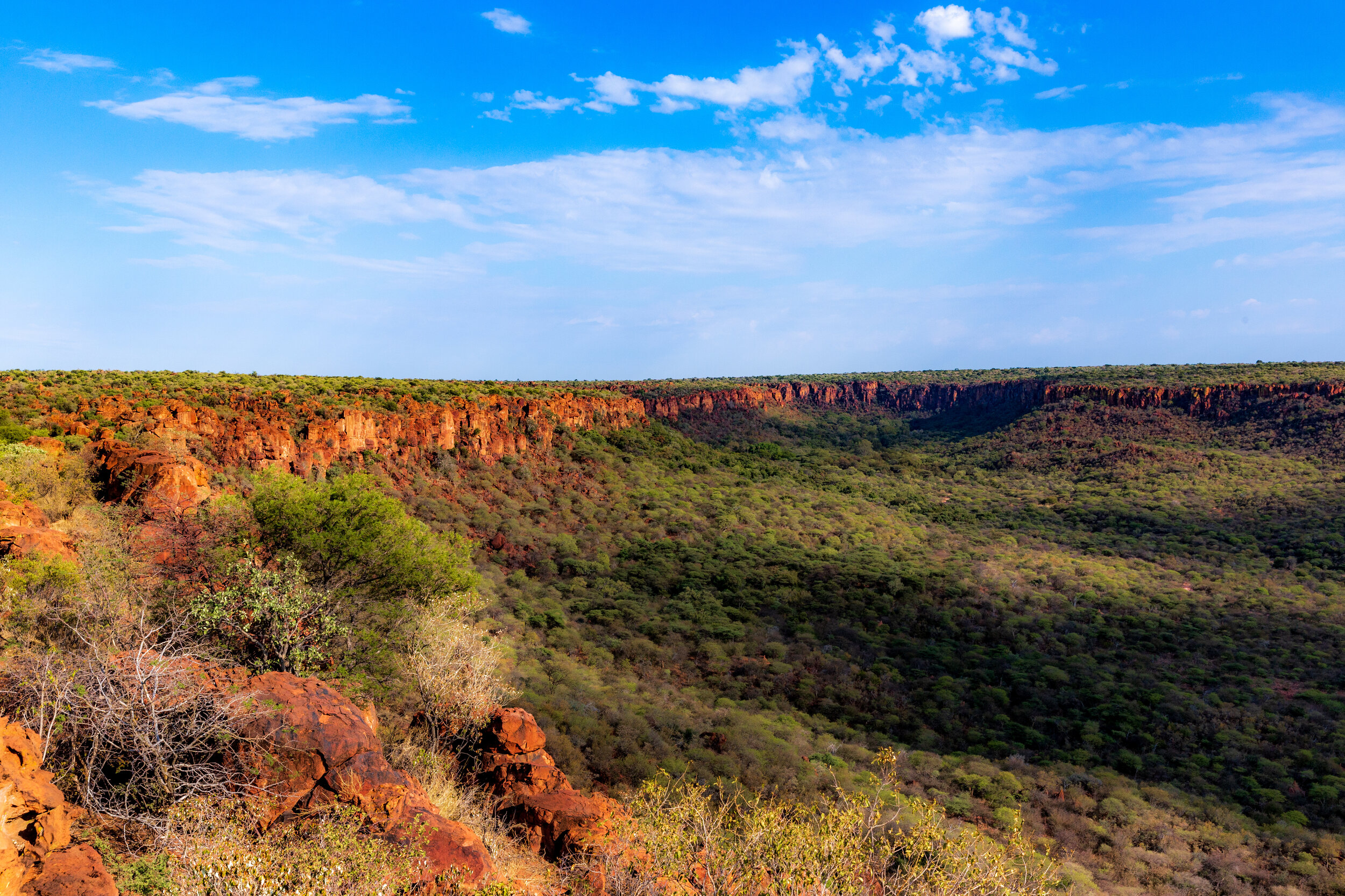
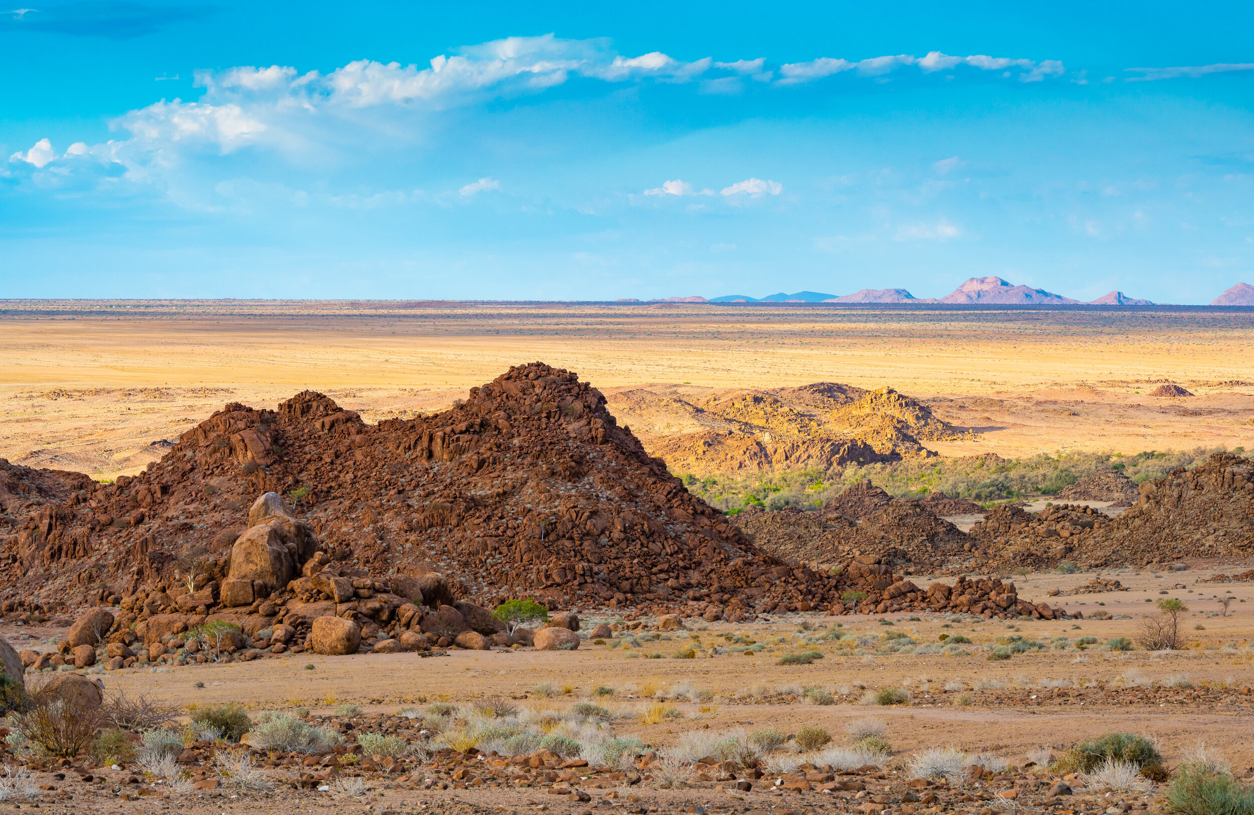
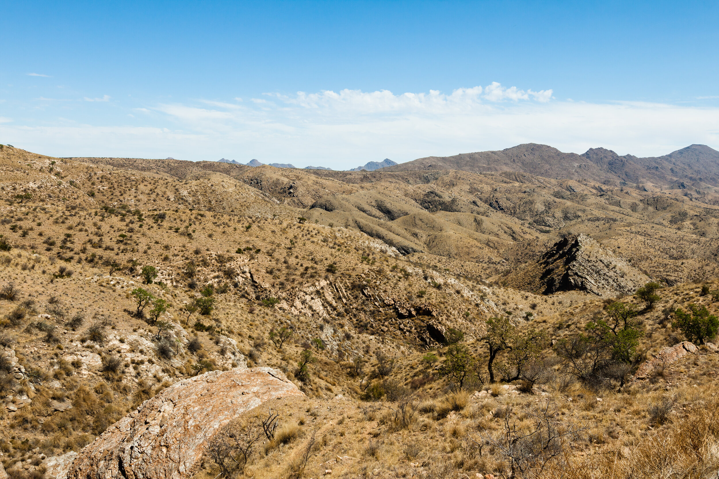
Brukkaros Mountain rises some 600 m above the arid Kalahari plains in the Karas region of Namibia. Its distinct geology and shape, which resembles a volcanic crater, is owed to it being a caldera — a collapsed magma eruption. This secret hiking spot is not mentioned in many guidebooks and will have you trekking off the beaten path! A challenging 3-4 hour round route will get you to the summit and back, and an additional trail will land you at the ruins of a former German observatory and a National Geographic research station. You will scramble over some oxide-red boulders and stones, witness intriguing crystal formations and straddle some perennial streams, all alongside magnificent views of the surrounding Hanam plateau and Berseba town.
The hike starts out on a steep and narrow path from the upper campsite, meandering for 1.5 km to a rocky waterfall. From here you can choose to either explore the caldera or to take a sharp left turn and scramble a further 500 m to the rim itself. The rim path continues for 4.5 km to the northern part where you’ll find the abandoned buildings. You will follow the same route to get back down.
Try to head out early in the morning to avoid the 40-degree midday heat. There are two campsites - an upper and a lower - at the base of the crater, from where the hike starts. The lower campsite can be reached with a 2x4, however, the upper campsite can only be reached with a 4x4. The campsites have not been maintained, and there are no toilets, shade or water. You do not need to book, as you are essentially free camping (it is legal here). You will need to bring everything along with you for your stay as there are no amenities, fuel or food on site. The nearest village is Berseba, where there are basic shops and a fuel station.
How to get there:
Access is via the M98, signposted off the B1 to the village of Berseba (!Autsawises in Nama), which lies 38 km down the road, and where there are a couple of basic shops and a fuel station. About a kilometre before the village itself there is a poorly marked dirt road, the D3904, which after 10 km will get you to the base of Brukkaros Mountain.
9. Klein-Aus Vista Hiking Trails
Level: Easy - Hard
Distance: Depends on the route taken (4 - 20 km)
Accessible: All-year-round
Drinkable water on the route: No
Starting point: Depends on the chosen trail
Close to: Aus, Lüderitz, Kolmanskop, Keetmanshoop
There are several marked hiking trails at Klein-Aus Vista that guide you through the wildly romantic scenery of the Aus Mountains, enveloping you in the unique flora and fauna of the Succulent Karoo desert. The trails cater to beginners and experienced hikers. There are 6 different hiking trails to choose from: Schanzen, Vista, Schutztruppe, Mountain, Geister and Eagle (check the Gondwana Klein-Aus Vista's website for descriptions and maps of each trail). There is an Information Kiosk with detailed maps and information at the starting point of each trail. Make sure to purchase a permit at the Desert Horse Inn reception.
Multi-day hikes:
1. Fish River Trail, /Ai-/Ais Richtersveld Transfrontier Park (unguided)
Level: Moderate -Hard
Number of days: 5 - 7
Distance: 80 km with shortcuts
Elevation gain: 2.232 m
Accessible: May 1st - September 15th
Drinkable water on the route: Yes but has to be purified
Starting point: Hobas
Close to: Keetmanshoop, South Africa, Lüderitz
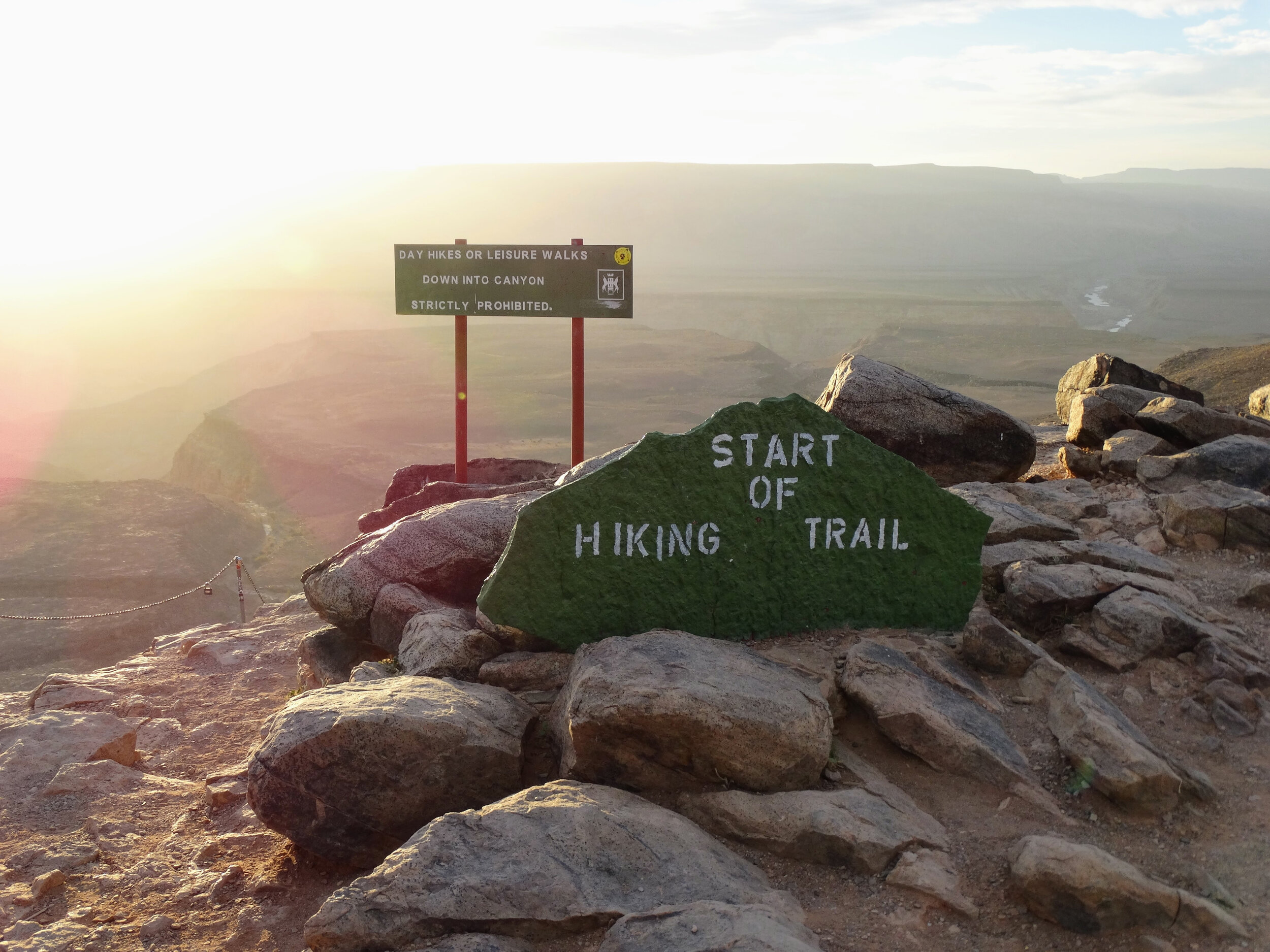
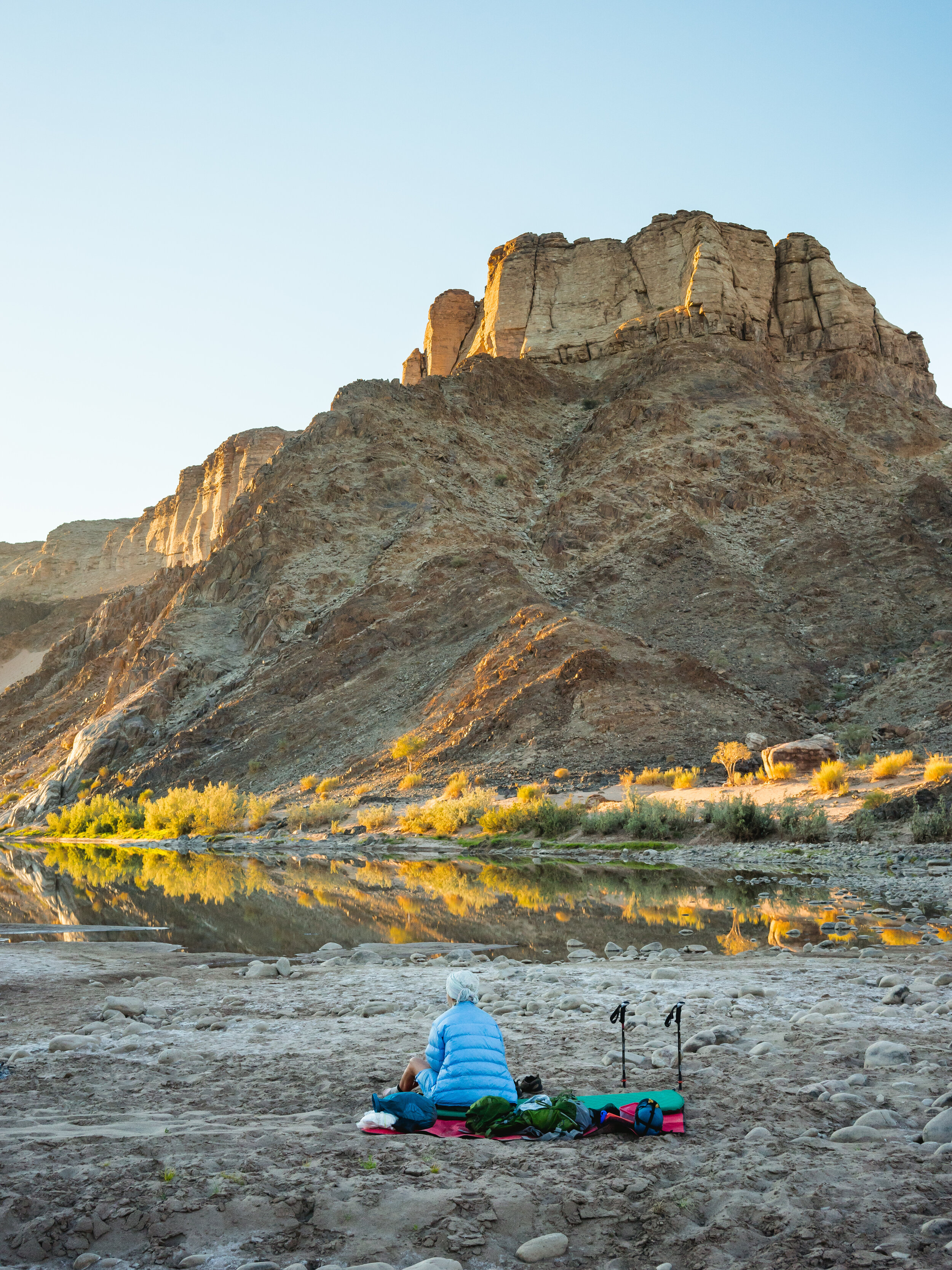
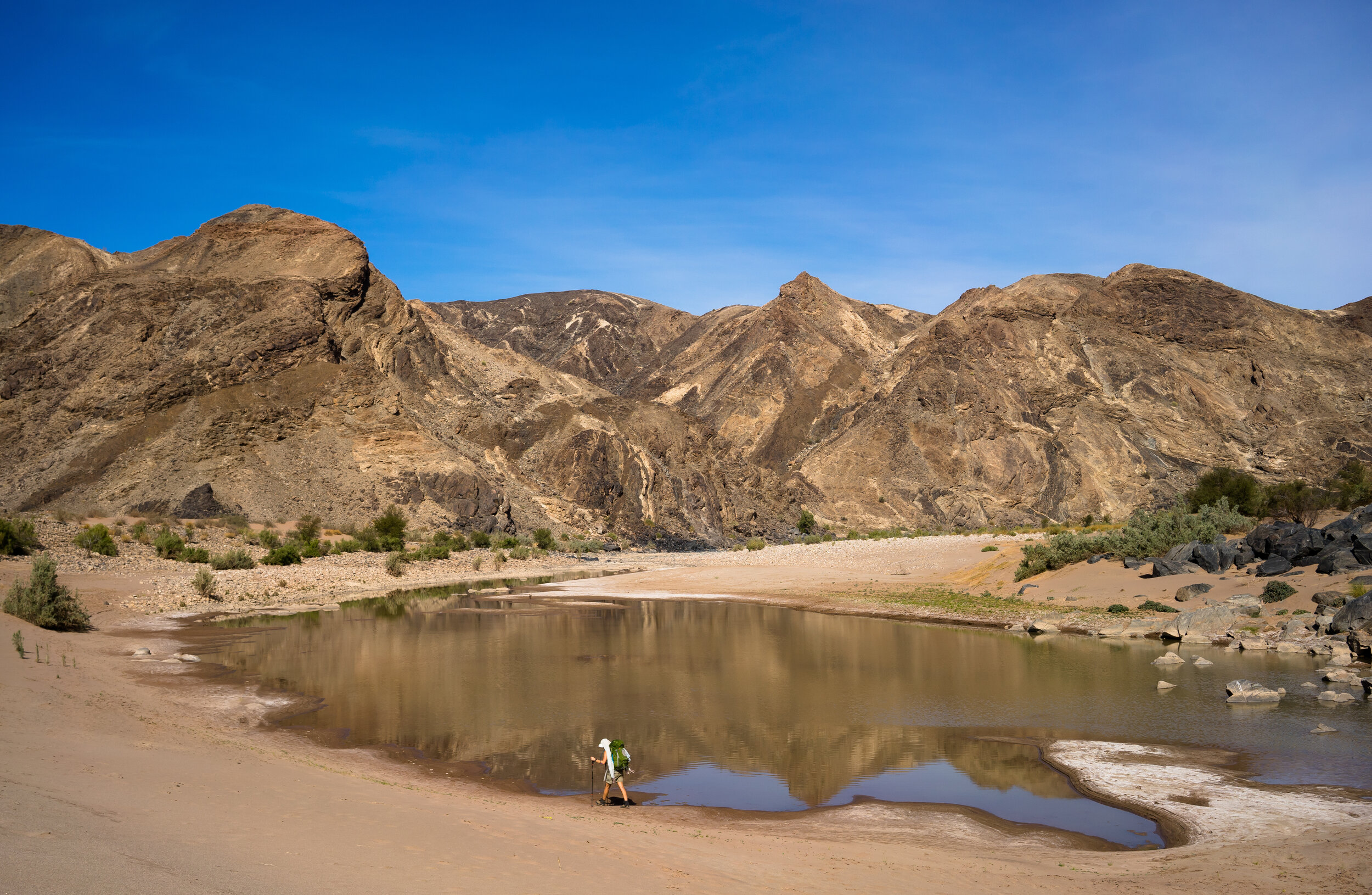
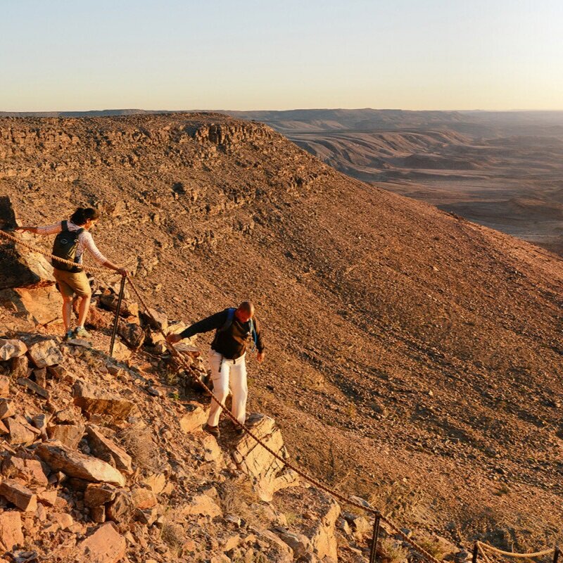
This is one of the most popular treks in all of southern Africa and for good reason. It is only open for 30 hikers per day and has to be booked well in advance (sometimes up to 1 year!). This life-changing hike from Hobas to Ai-Ais is the best way to experience the stark and rugged scenery of the world's second-largest canyon. The trail is completely unsupported and you will have to pack all of your food, sleeping and cooking equipment and clothes, but the daily trek will have been so worth it. Your first day comprises descending the steep canyon wall into the ravine far, far below. You will then spend your days meandering through enormous rocky gorges, sleep under the twinkling milky way, enjoy absolute solitude and raw, untamed nature. The hike only costs NAD 330 per person, plus NAD80 for the park entrance fee and NAD 270 for the shuttle that will fetch you at the end of the trail and return you to Hobas. You can book the hike through Namibia Wildlife Resorts (NWR) in Windhoek (+264) 61 285 7333 reservations@nwr.com.na or in Cape Town (+27) 21 422 3761 ct.bookings@nwr.com.na. You will need a minimum of 3 people in your group and a maximum of 20 and all hikers will need to present a doctor's letter sent by NWR stating that they are fit and healthy enough to do the hike (no older than 40 days). Make sure to pack a physical map and GPS (check out this handy map with the route, points of interest and recommended rest stops indicated).
2. Khomas Hochland Hiking Trails (KHHT) (unguided)
Level: Moderate
Number of days: 4 - 6 days
Distance: 54 km or 90 km
Accessible: All-year-round
Drinkable water on the route: No
Starting point: Duesternbrook Safari Guest Farm
Close to: Windhoek
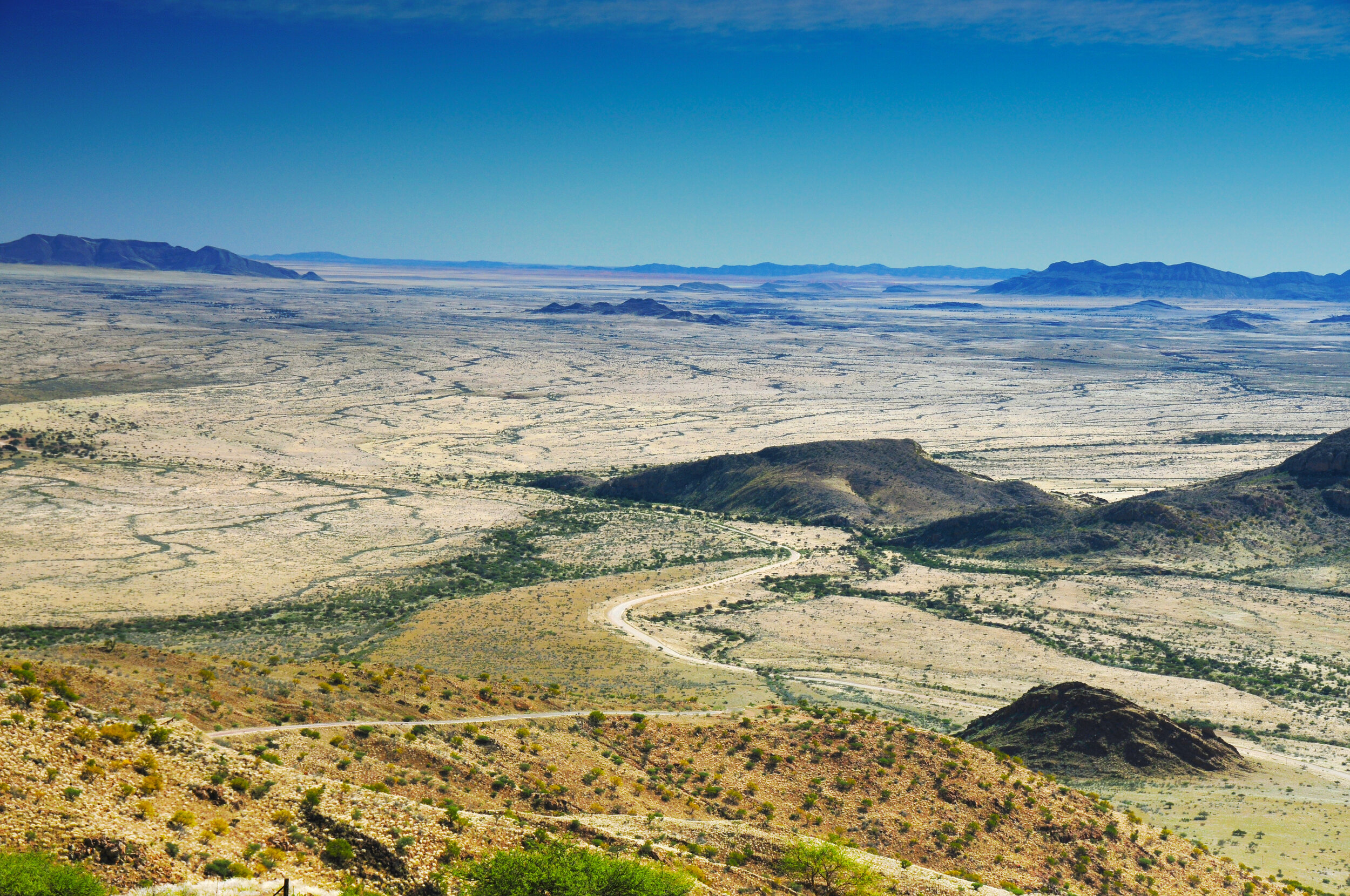
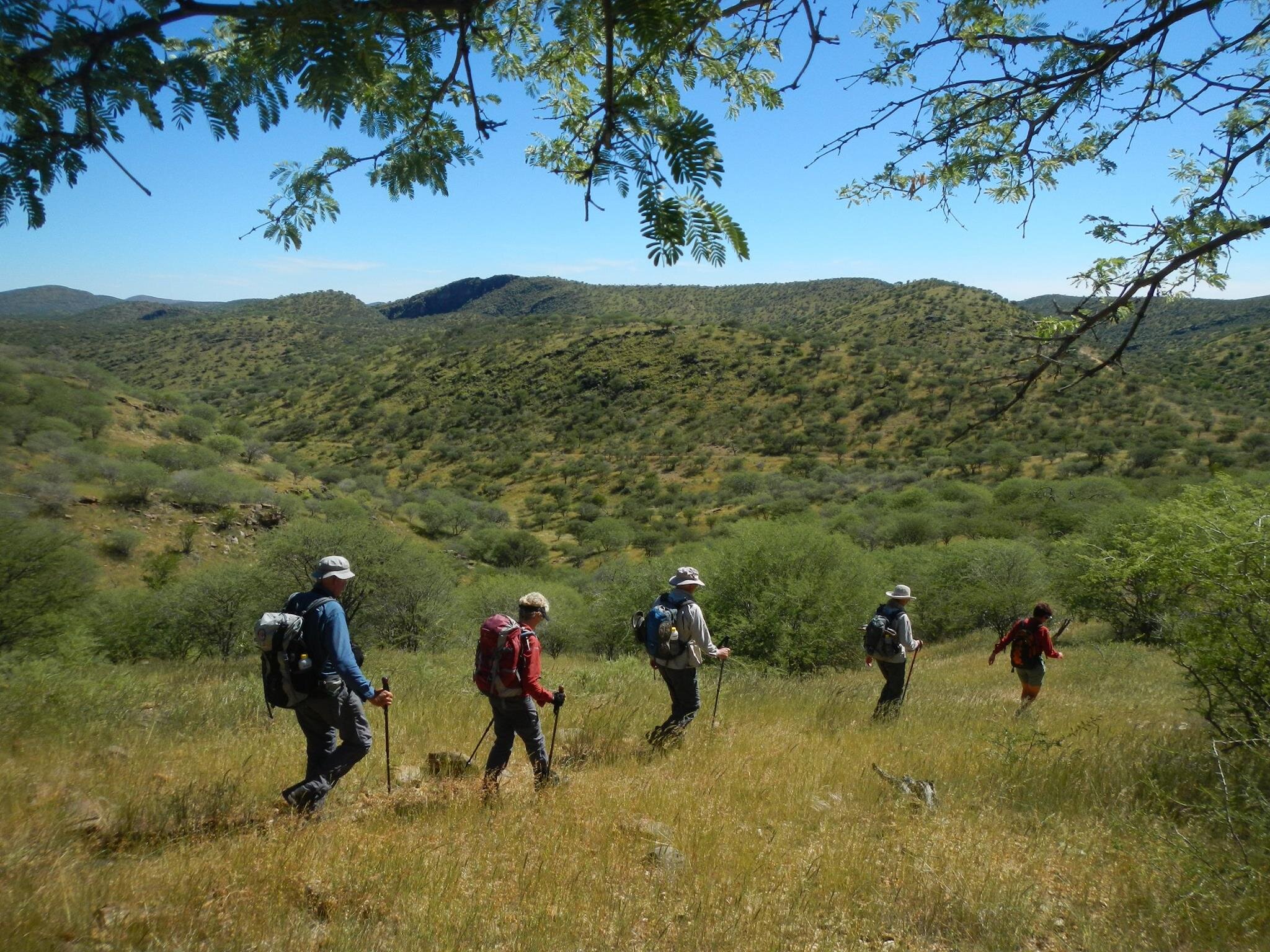
A stone's throw from Windhoek, both circular trails wind through an alluring and rugged part of Namibia's Khomas Hochland Plateau region, crossing 5 farms — Duesternbrook, Otjiseva, Onduno, Godeis and Monte Christo — over steps using old car tyres. The KHHT is within the Windhoek Green Belt Conservation Area Landscape, an initiative by the Ministry of Environment and Tourism. Hikers interested in geology, bird-watching, fauna and flora, and archaeology can expect to be enthralled by both trails. Routes are well marked, and overnight rest stops cater for all hikers' needs, including hot showers (solar or 'donkey' boiler heated), toilets, barbeque facilities and a protected sleeping area. Large trees dot the trail, offering cooling shade and a refuge for all kinds of animals, including oryx, kudu, warthogs, zebra, baboons, waterbuck and klipspringer. There is also abundant birdlife along the Aretaragas and Otjiseva rivers on the trails, so keep an eye out for eagles, lovebirds and waterbirds. Trail reservations should be made in advance with the Dusternbrook Guest Farm via telephone (+264 61 232 572) or email (info@duesternbrook.net).
There are also shorter day trails on Dueternbrook, Godeis and Monte Cristo farms, ranging from 5 - 18 km.
3. Fish River Canyon Slackpacking, /Ai-/Ais Richtersveld Transfrontier Park (guided)
If you are not keen on the rigorous traditional Fish River Trail, but you would like to experience the majestic canyon, then rather opt for a slackpacking option with either Journeys Namibia or Gondwana Collection, both of whom will carry all your supplies to your charming rest camp for the night.
2.1 Journeys Namibia, 2-3 days Rim to River

The 2-day and 3-day hikes include a knowledgeable guide, breakfast, lunch and dinner plus drinks while slackpacking. A minimum of 2 guests and a maximum of 10 guests per group are allowed. You will be sleeping in unique stone gabion shelters that overlook the mesmerising, colour-shifting canyon and its rock formations.
2.2 Gondwana Collection, 3-4 days

Hike the northern reaches of the canyon over 3 to 4 days, without having to carry your food, clothes or sleeping equipment, just your camera and water bottle! There are 3 slackpacking routes to choose from: the Klipspringer Trail (17 km hike, 3 nights), the Zebra Trail (35 km, 3 nights) and the Fish Eagle Trail (35 km, 4 nights). After each thrilling day of hiking through the canyon, you will stay in one of 4 ‘Klipspringer Camps’ (Base Station, Battlesnake, Koelkrans and Horseshoe), some along the rim and others in the canyon. A minimum of 4 people and a maximum of 14 are allowed per group.
4. Etendeka Walking Trail, Grootberg Massif (guided)
Level: Easy - Moderate
Number of days: 3
Accessible: All-year-round (closed in January)
Drinkable water on the route: Provided
Starting point: Palmwag Lodge
Close to: Bergsig, Skeleton Coast National Park, Etosha National Park
Wander and sleep in pristine nature in the Etendeka Concession at the foot of the towering Grootberg Mountains. This guided trail is off the beaten track and offers adventurers the chance to be fully immersed in unspoiled, spectacular scenery. Your knowledgeable guide will teach you all there is to know about the animals and geology of the region and can take groups of up to 8 people.
On day 1, you will hike from Palmwag Lodge to the River Camp for 2-3 hours (your luggage will be transported for you). The River Camp is an African-Esque hideout next to a frequented waterhole, with bathrooms and shade. Your dinner will be prepared over an open fire and enjoyed while your guide relays riveting stories over the campfire. Look skyward to catch unparalleled starry skies.
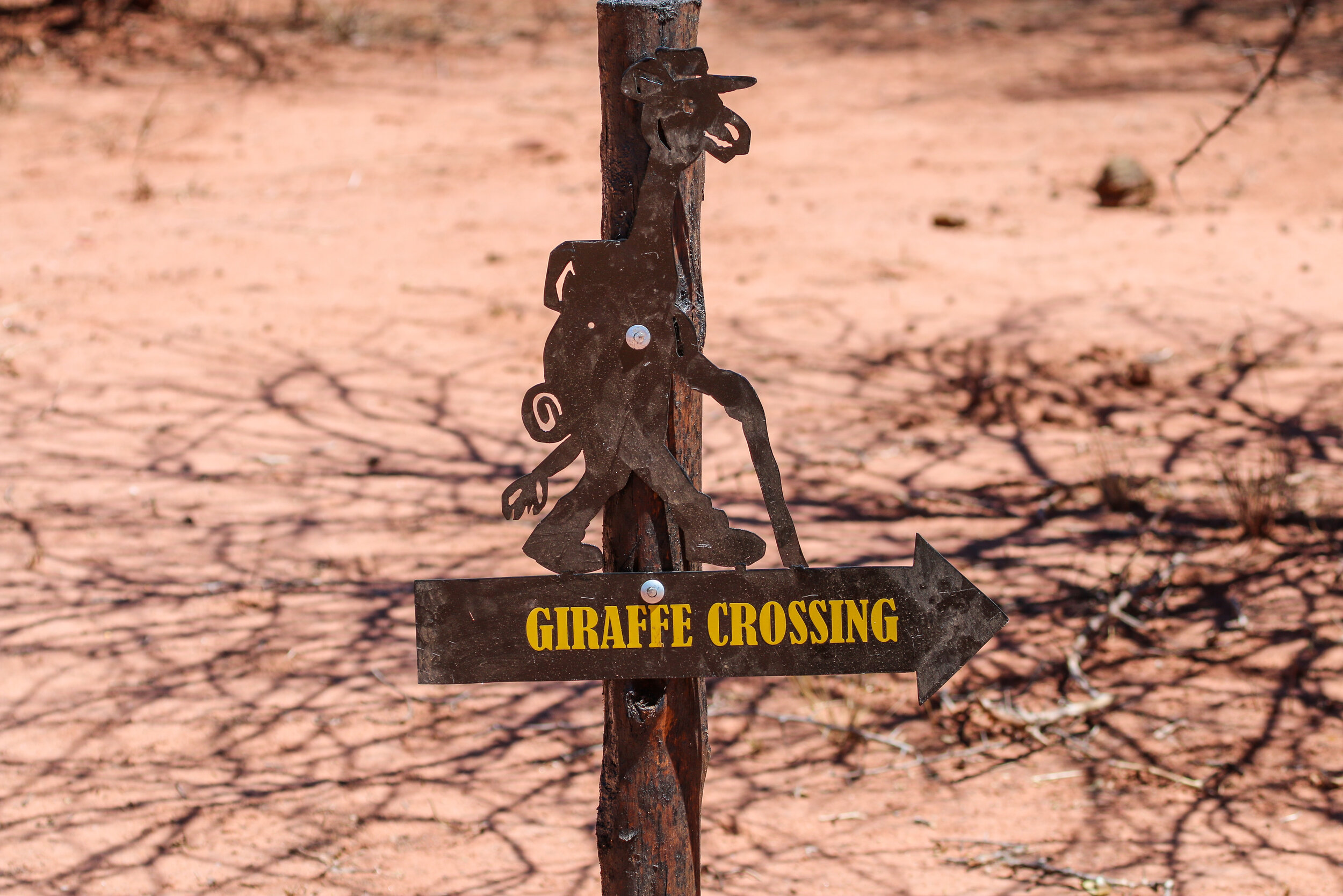
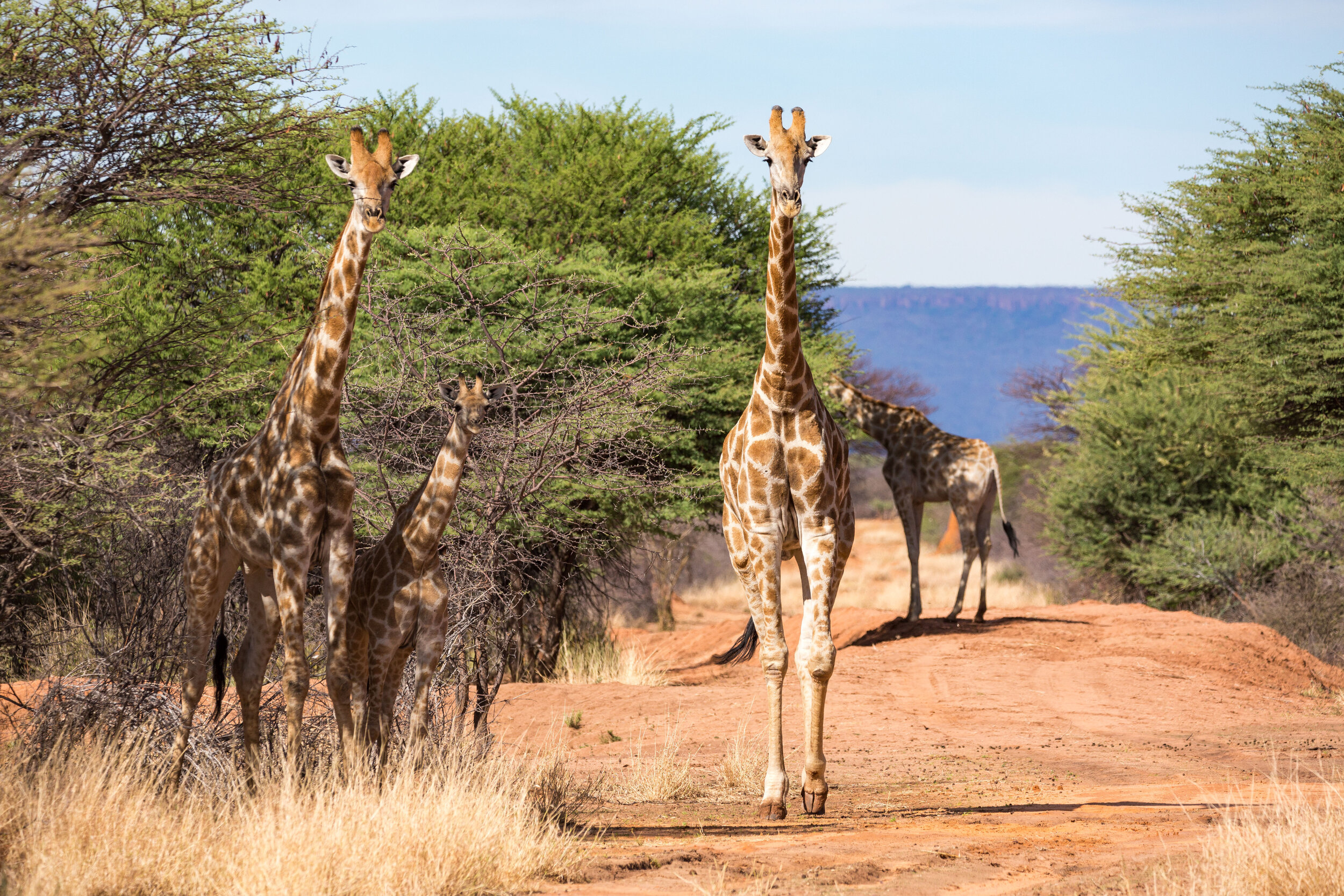
On day 2, you will enjoy an early breakfast and then embark on your 15-20 km hike to the Mountain Camp. You will meander along rocky plains alongside ancient Etendeka-Basalt formations, flat mountains, giraffes, mountain zebras, oryx, steenbok, and for a lucky some, desert-adapted elephants and black rhino! Mountain Camp is atop Crystal Mountain and offers panoramic vistas across the plateau. In the cool afternoon, you can go for a walk around the plateau before indulging in a delicious dinner.
On day 3, after a short walk, you will drive back to Palmwag Lodge through the expansive landscape.
5. Tok Tokkie Trail, NamibRand Nature Reserve (guided)
Level: Easy
Number of days: 3
Distance: 22 km
Accessible: Mid-February to Mid-December
Drinkable water on the route: Provided
Starting point: Tok Tokkie Farmhouse (Tok Tokkie Trails)
Close to: Sossusvlei, Namib Naukluft, Aus, Lüderitz, Mariental
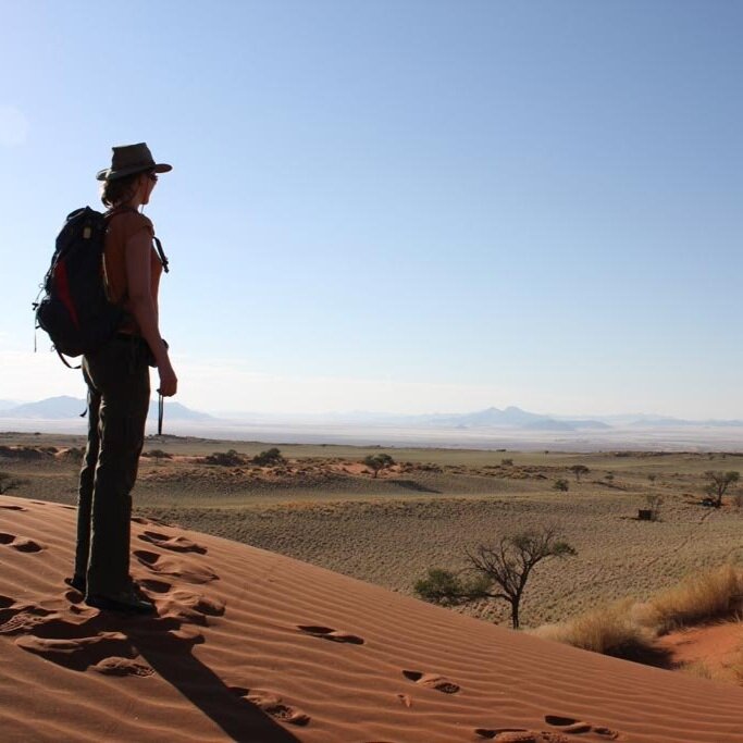
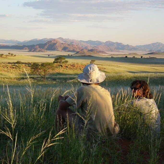
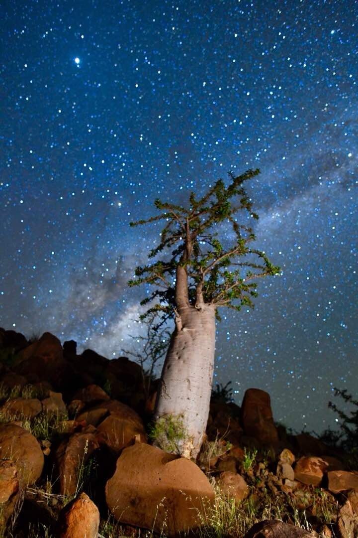
This fun-for-all trail makes its way through the wondrous Namib Desert, one of few International Dark Sky Reserves in the world. You will not have to carry anything, leaving you free to run down the dunes and explore the surrounding tranquil landscape. Your experienced guide will share the secrets of the desert with you and point out up to 100 bird species, plus oryx, ostriches, golden moles, barking geckos and bat-eared foxes!
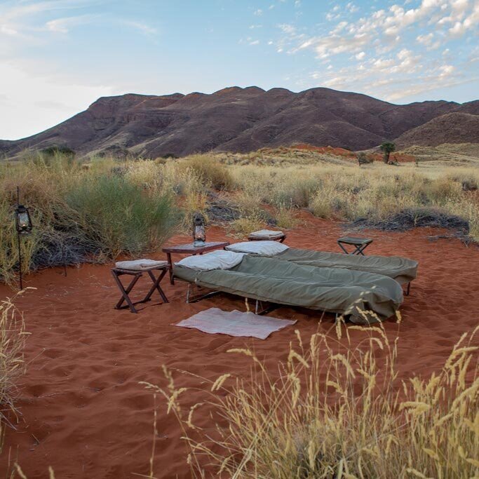
On day 1, you will start off your adventure with a visit to the Namib Desert Environmental Education Trust (NaDEET), a non-profit trust, which aims to develop environmentally responsible citizens of Namibia. Afterwards, a short drive will get you to the start of the trail. You will walk across rock-strewn plains, passing the mysterious ‘fairy-circles’ and rolling vegetated sand dunes. Your camp is nestled between the coral-hued dunes and features a hot shower and stretchers for sleeping on. After an open-air, scrumptious three-course meal, you will retire to your stretcher under a blanket of twinkling stars.
On day 2, you will have coffee or tea before sunrise, setting off into the cool dunes, keeping an eye out for the endemic dune lark. You walk over a mountain saddle before descending gently to a dry riverbed. Take reprieve and lunch in the shade before heading off for camp, set against a mountainous backdrop. After an early start on day 3, you will meander through the duned plains dotted with camelthorn trees, reaching the Tok Tokkie farmhouse by mid-morning. This trail is suitable for kids from 8 years old and can host a maximum of 8 guests.
6. Namib100
Level: Moderate
Number of days: 5
Distance: 100 km
Accessible: All-year-round
Drinkable water on the route: Provided
Starting point: Walvis Bay
Close to: Walvis Bay, Namib Naukluft National Park, Skeleton Coast, Lüderitz

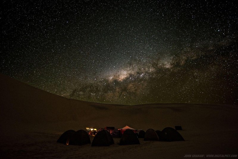
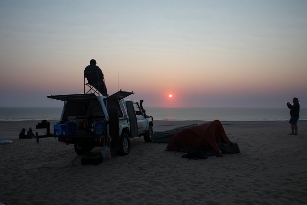
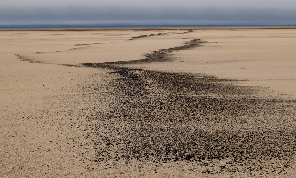
This 100 km slack-packing hike into the forbidden land is worthy of a bucket-list mention. Fully supported and catered over 5 days, you will hike through the oldest desert on earth – the Namib – exploring Namibia's most dramatic scenery. Starting just outside Walvis Bay, you have exclusive access to areas in Sperrgebiet and along the Skeleton Coast. Think shipwrecks, stars, sealife, pink salt pans and sand dunes.
On Day 1, you will wander for 21 km, taking in the abundant bird and sea life at Sandwich Harbour, a Ramsar-listed wetland.
On Day 2, 25 km of roaming will take you past colossal seal colonies on your way to Langewand, where the dunes dip directly into the ocean.
Day 3 takes you past shipwrecks and up onto the ancient dunes of the Namib. You can expect to soak up the dramatic scenery for 24km.
Day 4 is all about the micro faces of the Namib. You will explore the dunes and be introduced to the tough critters and plants that persist in this forbidden landscape. After 20 km, your camp for the night is near a classic 'ghost town', where shifting sands have invaded the houses of a bygone era.
On day 5, you return to the sea, crossing pink salt pans and ancient shell-littered ocean floors. You'll finish your hike and be greeted with a glass of cooling bubbly at a famous shipwreck before driving back to Walvis Bay.
To check availability and book, visit namib100hike.com. For your obligatory stay in Walvis Bay the night before the hike, you can find and book all sorts of sustainable stays on our site.
Bonus hike
The gruelling, unsupported 4-day (58 km) or 8-day (120 km) Namib Naukluft Hiking Trail. This hike is only for very experienced hikers, with high levels of fitness and ample equipment and supplies. Do thorough research before considering this hike!
What to take on your hike:
Good quality hiking boots/shoes that you have worn a few times before (otherwise you’ll get nasty blisters)
Reusable water bottles to the equivalent of 2 litres
A wide-brim hat
Sunblock
Lightweight clothing that covers your arms, shoulders and legs
Thick socks made from a breathable material like mohair
A physical map of your route
For day hikes, a 20 to 35 litre, sturdy backpack, and for multi-day hikes, you’ll want a quality (and comfortable) backpack between 50 and 70 litres in volume
Basic first aid supplies
For a multi-day, unsupported hike you’ll have to do loads of food prep to make sure what you carry is enough for the duration of the hike, but not too heavy
If you are relying on the water on the trail for drinking, you might need to purify it (using a purifier or tablets)
For overnight hikes, you’ll need a sleeping bag and a roll-up mattress (like a yoga matt or a thin self-inflating one)
Check whether you need a tent on your hike, as sleeping directly under the stars is an unforgettable experience, and will lighten your load
Strapped your hiking boots on already in anticipation? No matter where your Namibian hiking adventure takes you, you are guaranteed unparalleled vistas, engagement with nature and personal triumph. You can incorporate a hike into your trip, or plan a trip around a hike! Either way, you should book your life-changing adventure today.